You are here: Home > Network List > IW - Intermountain West Stations List
> Station DLMT Dillon, Montana, USA > Earthquake Result Viewer
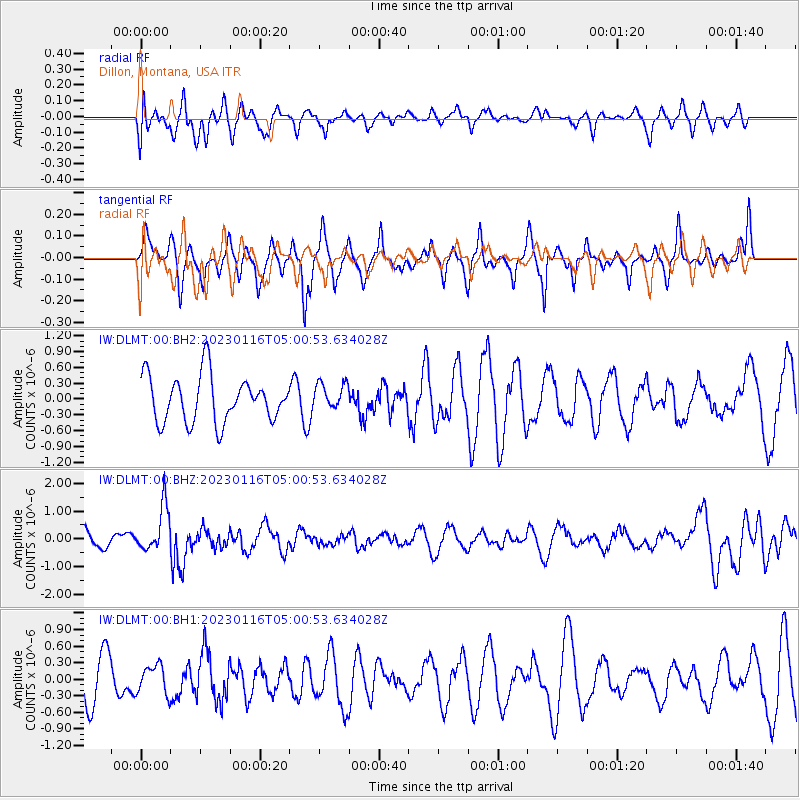
DLMT Dillon, Montana, USA - Earthquake Result Viewer
*The percent match for this event was below the threshold and hence no stack was calculated.
| Earthquake location: |
Bonin Islands, Japan Region |
| Earthquake latitude/longitude: |
29.0/139.4 |
| Earthquake time(UTC): |
2023/01/16 (016) 04:49:52 GMT |
| Earthquake Depth: |
405 km |
| Earthquake Magnitude: |
6.3 mww |
| Earthquake Catalog/Contributor: |
NEIC PDE/us |
|
| Network: |
IW Intermountain West |
| Station: |
DLMT Dillon, Montana, USA |
| Lat/Lon: |
45.36 N/112.60 W |
| Elevation: |
1569 m |
|
| Distance: |
81.3 deg |
| Az: |
42.693 deg |
| Baz: |
302.58 deg |
| Ray Param: |
$rayparam |
*The percent match for this event was below the threshold and hence was not used in the summary stack. |
|
| Radial Match: |
38.46188 % |
| Radial Bump: |
389 |
| Transverse Match: |
51.73086 % |
| Transverse Bump: |
267 |
| SOD ConfigId: |
29823551 |
| Insert Time: |
2023-01-30 05:09:03.351 +0000 |
| GWidth: |
2.5 |
| Max Bumps: |
400 |
| Tol: |
0.001 |
|
Signal To Noise
| Channel | StoN | STA | LTA |
| IW:DLMT:00:BHZ:20230116T05:00:53.634028Z | 2.3238506 | 8.2523627E-7 | 3.5511587E-7 |
| IW:DLMT:00:BH1:20230116T05:00:53.634028Z | 0.6284977 | 2.5805758E-7 | 4.1059434E-7 |
| IW:DLMT:00:BH2:20230116T05:00:53.634028Z | 0.5726049 | 2.5038557E-7 | 4.3727457E-7 |
| Arrivals |
| Ps | |
| PpPs | |
| PsPs/PpSs | |


