MM18 Tyson, Missiouri - Earthquake Result Viewer
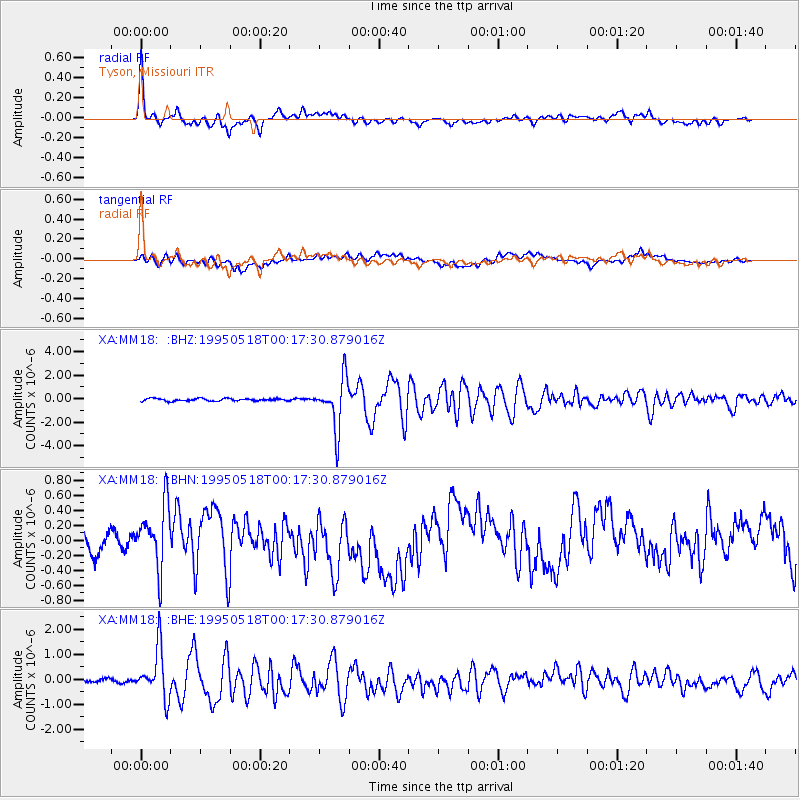
Earthquake location: Central Mid-Atlantic Ridge
Earthquake latitude/longitude: -0.9/-22.0
Earthquake time(UTC): 1995/05/18 (138) 00:06:26 GMT
Earthquake Depth: 10 km
Earthquake Magnitude: 6.2 MB, 6.1 MS, 6.8 UNKNOWN, 6.7 MW
Earthquake Catalog/Contributor: WHDF/NEIC
Network: XA Missouri to Massachusetts Transect
Station: MM18 Tyson, Missiouri
Lat/Lon: 38.53 N/90.57 W
Elevation: 186 m
Distance: 74.0 deg
Az: 310.561 deg
Baz: 104.423 deg
Ray Param: 0.052648015
Estimated Moho Depth: 13.75 km
Estimated Crust Vp/Vs: 2.03
Assumed Crust Vp: 6.498 km/s
Estimated Crust Vs: 3.209 km/s
Estimated Crust Poisson's Ratio: 0.34
Radial Match: 88.48652 %
Radial Bump: 400
Transverse Match: 50.343723 %
Transverse Bump: 400
SOD ConfigId: 6273
Insert Time: 2010-02-26 17:57:13.264 +0000
GWidth: 2.5
Max Bumps: 400
Tol: 0.001

Signal To Noise

ChannelStoNSTALTA
XA:MM18: :BHN:19950518T00:17:30.879016Z1.76038474.1773814E-72.3729935E-7
XA:MM18: :BHE:19950518T00:17:30.879016Z5.89716679.762808E-71.6555082E-7
XA:MM18: :BHZ:19950518T00:17:30.879016Z19.8701952.1178578E-61.0658465E-7
Arrivals
Ps2.2 SECOND
PpPs6.2 SECOND
PsPs/PpSs8.4 SECOND