You are here: Home > Network List > US - United States National Seismic Network Stations List
> Station ELK Elko, Nevada, USA > Earthquake Result Viewer
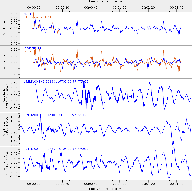
ELK Elko, Nevada, USA - Earthquake Result Viewer
*The percent match for this event was below the threshold and hence no stack was calculated.
| Earthquake location: |
Bonin Islands, Japan Region |
| Earthquake latitude/longitude: |
29.0/139.4 |
| Earthquake time(UTC): |
2023/01/16 (016) 04:49:52 GMT |
| Earthquake Depth: |
405 km |
| Earthquake Magnitude: |
6.3 mww |
| Earthquake Catalog/Contributor: |
NEIC PDE/us |
|
| Network: |
US United States National Seismic Network |
| Station: |
ELK Elko, Nevada, USA |
| Lat/Lon: |
40.74 N/115.24 W |
| Elevation: |
2210 m |
|
| Distance: |
82.1 deg |
| Az: |
47.684 deg |
| Baz: |
301.498 deg |
| Ray Param: |
$rayparam |
*The percent match for this event was below the threshold and hence was not used in the summary stack. |
|
| Radial Match: |
53.40032 % |
| Radial Bump: |
313 |
| Transverse Match: |
57.45869 % |
| Transverse Bump: |
326 |
| SOD ConfigId: |
29823551 |
| Insert Time: |
2023-01-30 05:16:52.019 +0000 |
| GWidth: |
2.5 |
| Max Bumps: |
400 |
| Tol: |
0.001 |
|
Signal To Noise
| Channel | StoN | STA | LTA |
| US:ELK:00:BHZ:20230116T05:00:57.77502Z | 3.8592098 | 6.967728E-7 | 1.8054806E-7 |
| US:ELK:00:BH1:20230116T05:00:57.77502Z | 0.36769667 | 8.735544E-8 | 2.3757472E-7 |
| US:ELK:00:BH2:20230116T05:00:57.77502Z | 1.3578246 | 2.9358787E-7 | 2.1621928E-7 |
| Arrivals |
| Ps | |
| PpPs | |
| PsPs/PpSs | |


