You are here: Home > Network List > US - United States National Seismic Network Stations List
> Station NEW Newport, Washington, USA > Earthquake Result Viewer
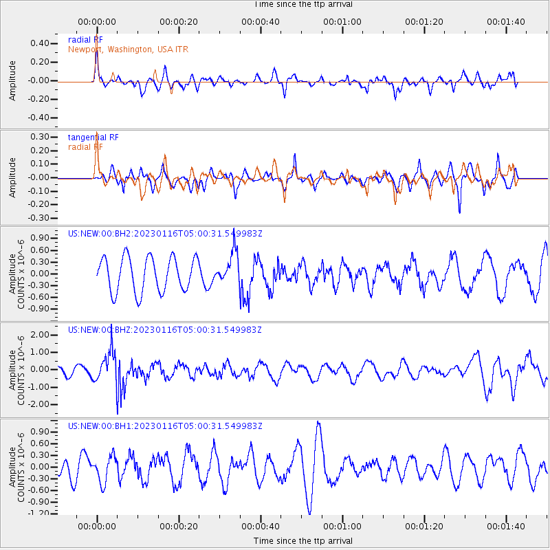
NEW Newport, Washington, USA - Earthquake Result Viewer
*The percent match for this event was below the threshold and hence no stack was calculated.
| Earthquake location: |
Bonin Islands, Japan Region |
| Earthquake latitude/longitude: |
29.0/139.4 |
| Earthquake time(UTC): |
2023/01/16 (016) 04:49:52 GMT |
| Earthquake Depth: |
405 km |
| Earthquake Magnitude: |
6.3 mww |
| Earthquake Catalog/Contributor: |
NEIC PDE/us |
|
| Network: |
US United States National Seismic Network |
| Station: |
NEW Newport, Washington, USA |
| Lat/Lon: |
48.26 N/117.12 W |
| Elevation: |
760 m |
|
| Distance: |
77.2 deg |
| Az: |
41.781 deg |
| Baz: |
299.12 deg |
| Ray Param: |
$rayparam |
*The percent match for this event was below the threshold and hence was not used in the summary stack. |
|
| Radial Match: |
45.55914 % |
| Radial Bump: |
393 |
| Transverse Match: |
52.274143 % |
| Transverse Bump: |
330 |
| SOD ConfigId: |
29823551 |
| Insert Time: |
2023-01-30 05:17:03.323 +0000 |
| GWidth: |
2.5 |
| Max Bumps: |
400 |
| Tol: |
0.001 |
|
Signal To Noise
| Channel | StoN | STA | LTA |
| US:NEW:00:BHZ:20230116T05:00:31.549983Z | 5.766488 | 9.120133E-7 | 1.5815749E-7 |
| US:NEW:00:BH1:20230116T05:00:31.549983Z | 1.0224643 | 3.3803911E-7 | 3.3061212E-7 |
| US:NEW:00:BH2:20230116T05:00:31.549983Z | 0.93925464 | 4.0877163E-7 | 4.3520853E-7 |
| Arrivals |
| Ps | |
| PpPs | |
| PsPs/PpSs | |


