You are here: Home > Network List > UU - University of Utah Regional Network Stations List
> Station FORU South Mineral Mountains, UT, USA > Earthquake Result Viewer
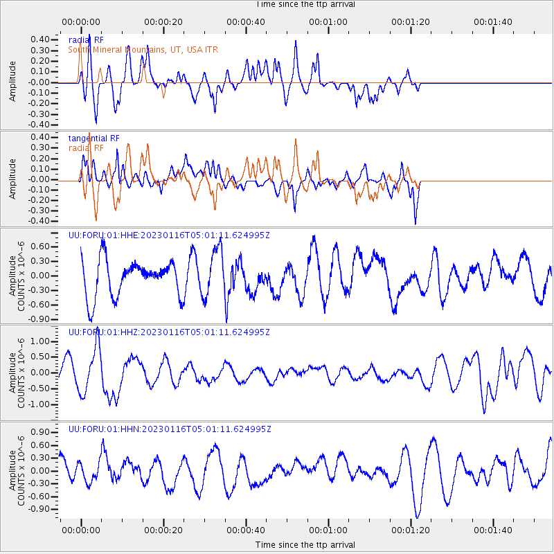
FORU South Mineral Mountains, UT, USA - Earthquake Result Viewer
*The percent match for this event was below the threshold and hence no stack was calculated.
| Earthquake location: |
Bonin Islands, Japan Region |
| Earthquake latitude/longitude: |
29.0/139.4 |
| Earthquake time(UTC): |
2023/01/16 (016) 04:49:52 GMT |
| Earthquake Depth: |
405 km |
| Earthquake Magnitude: |
6.3 mww |
| Earthquake Catalog/Contributor: |
NEIC PDE/us |
|
| Network: |
UU University of Utah Regional Network |
| Station: |
FORU South Mineral Mountains, UT, USA |
| Lat/Lon: |
38.46 N/112.86 W |
| Elevation: |
1840 m |
|
| Distance: |
84.9 deg |
| Az: |
48.638 deg |
| Baz: |
303.116 deg |
| Ray Param: |
$rayparam |
*The percent match for this event was below the threshold and hence was not used in the summary stack. |
|
| Radial Match: |
65.87981 % |
| Radial Bump: |
400 |
| Transverse Match: |
78.56827 % |
| Transverse Bump: |
400 |
| SOD ConfigId: |
29823551 |
| Insert Time: |
2023-01-30 05:17:16.376 +0000 |
| GWidth: |
2.5 |
| Max Bumps: |
400 |
| Tol: |
0.001 |
|
Signal To Noise
| Channel | StoN | STA | LTA |
| UU:FORU:01:HHZ:20230116T05:01:11.624995Z | 1.8610579 | 7.467844E-7 | 4.0126878E-7 |
| UU:FORU:01:HHN:20230116T05:01:11.624995Z | 0.8521254 | 2.2481021E-7 | 2.6382293E-7 |
| UU:FORU:01:HHE:20230116T05:01:11.624995Z | 1.3269217 | 4.9611845E-7 | 3.7388673E-7 |
| Arrivals |
| Ps | |
| PpPs | |
| PsPs/PpSs | |


