You are here: Home > Network List > UW - Pacific Northwest Regional Seismic Network Stations List
> Station DAVN Davenport, WA, USA > Earthquake Result Viewer
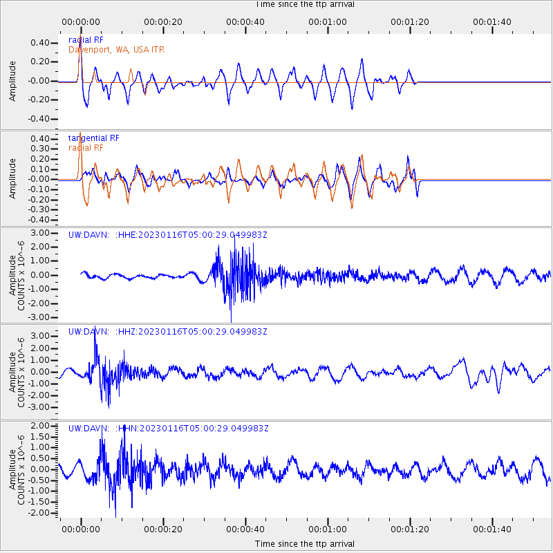
DAVN Davenport, WA, USA - Earthquake Result Viewer
*The percent match for this event was below the threshold and hence no stack was calculated.
| Earthquake location: |
Bonin Islands, Japan Region |
| Earthquake latitude/longitude: |
29.0/139.4 |
| Earthquake time(UTC): |
2023/01/16 (016) 04:49:52 GMT |
| Earthquake Depth: |
405 km |
| Earthquake Magnitude: |
6.3 mww |
| Earthquake Catalog/Contributor: |
NEIC PDE/us |
|
| Network: |
UW Pacific Northwest Regional Seismic Network |
| Station: |
DAVN Davenport, WA, USA |
| Lat/Lon: |
47.80 N/118.27 W |
| Elevation: |
483 m |
|
| Distance: |
76.7 deg |
| Az: |
42.58 deg |
| Baz: |
298.445 deg |
| Ray Param: |
$rayparam |
*The percent match for this event was below the threshold and hence was not used in the summary stack. |
|
| Radial Match: |
68.69779 % |
| Radial Bump: |
400 |
| Transverse Match: |
56.75124 % |
| Transverse Bump: |
391 |
| SOD ConfigId: |
29823551 |
| Insert Time: |
2023-01-30 05:18:01.102 +0000 |
| GWidth: |
2.5 |
| Max Bumps: |
400 |
| Tol: |
0.001 |
|
Signal To Noise
| Channel | StoN | STA | LTA |
| UW:DAVN: :HHZ:20230116T05:00:29.049983Z | 5.0486274 | 1.0240177E-6 | 2.0283092E-7 |
| UW:DAVN: :HHN:20230116T05:00:29.049983Z | 1.137134 | 4.3869258E-7 | 3.8578796E-7 |
| UW:DAVN: :HHE:20230116T05:00:29.049983Z | 5.0233407 | 6.6923724E-7 | 1.3322553E-7 |
| Arrivals |
| Ps | |
| PpPs | |
| PsPs/PpSs | |


