You are here: Home > Network List > UW - Pacific Northwest Regional Seismic Network Stations List
> Station IRON Crane, OR, USA > Earthquake Result Viewer
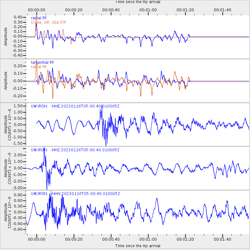
IRON Crane, OR, USA - Earthquake Result Viewer
*The percent match for this event was below the threshold and hence no stack was calculated.
| Earthquake location: |
Bonin Islands, Japan Region |
| Earthquake latitude/longitude: |
29.0/139.4 |
| Earthquake time(UTC): |
2023/01/16 (016) 04:49:52 GMT |
| Earthquake Depth: |
405 km |
| Earthquake Magnitude: |
6.3 mww |
| Earthquake Catalog/Contributor: |
NEIC PDE/us |
|
| Network: |
UW Pacific Northwest Regional Seismic Network |
| Station: |
IRON Crane, OR, USA |
| Lat/Lon: |
43.36 N/118.47 W |
| Elevation: |
1226 m |
|
| Distance: |
78.7 deg |
| Az: |
46.634 deg |
| Baz: |
299.164 deg |
| Ray Param: |
$rayparam |
*The percent match for this event was below the threshold and hence was not used in the summary stack. |
|
| Radial Match: |
69.83642 % |
| Radial Bump: |
325 |
| Transverse Match: |
43.58641 % |
| Transverse Bump: |
248 |
| SOD ConfigId: |
29823551 |
| Insert Time: |
2023-01-30 05:18:34.323 +0000 |
| GWidth: |
2.5 |
| Max Bumps: |
400 |
| Tol: |
0.001 |
|
Signal To Noise
| Channel | StoN | STA | LTA |
| UW:IRON: :HHZ:20230116T05:00:40.010005Z | 3.0985723 | 8.729602E-7 | 2.8172983E-7 |
| UW:IRON: :HHN:20230116T05:00:40.010005Z | 0.97762436 | 2.383293E-7 | 2.4378414E-7 |
| UW:IRON: :HHE:20230116T05:00:40.010005Z | 1.1230307 | 3.855432E-7 | 3.4330603E-7 |
| Arrivals |
| Ps | |
| PpPs | |
| PsPs/PpSs | |


