You are here: Home > Network List > AV - Alaska Volcano Observatory Stations List
> Station AMKA Regional Station, Amchitka Island, Alaska > Earthquake Result Viewer
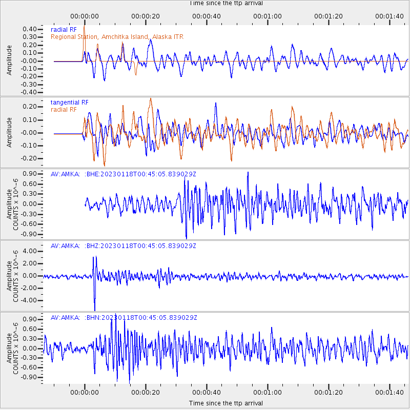
AMKA Regional Station, Amchitka Island, Alaska - Earthquake Result Viewer
*The percent match for this event was below the threshold and hence no stack was calculated.
| Earthquake location: |
Minahassa Peninsula, Sulawesi |
| Earthquake latitude/longitude: |
-0.0/123.2 |
| Earthquake time(UTC): |
2023/01/18 (018) 00:34:43 GMT |
| Earthquake Depth: |
147 km |
| Earthquake Magnitude: |
6.1 mww |
| Earthquake Catalog/Contributor: |
NEIC PDE/us |
|
| Network: |
AV Alaska Volcano Observatory |
| Station: |
AMKA Regional Station, Amchitka Island, Alaska |
| Lat/Lon: |
51.38 N/179.30 E |
| Elevation: |
116 m |
|
| Distance: |
69.6 deg |
| Az: |
33.724 deg |
| Baz: |
242.356 deg |
| Ray Param: |
$rayparam |
*The percent match for this event was below the threshold and hence was not used in the summary stack. |
|
| Radial Match: |
65.741486 % |
| Radial Bump: |
400 |
| Transverse Match: |
56.603127 % |
| Transverse Bump: |
400 |
| SOD ConfigId: |
29823551 |
| Insert Time: |
2023-02-01 00:40:33.514 +0000 |
| GWidth: |
2.5 |
| Max Bumps: |
400 |
| Tol: |
0.001 |
|
Signal To Noise
| Channel | StoN | STA | LTA |
| AV:AMKA: :BHZ:20230118T00:45:05.839029Z | 9.688804 | 1.5834454E-6 | 1.6343043E-7 |
| AV:AMKA: :BHN:20230118T00:45:05.839029Z | 1.2133601 | 2.054044E-7 | 1.6928561E-7 |
| AV:AMKA: :BHE:20230118T00:45:05.839029Z | 2.5151517 | 3.7800487E-7 | 1.5029109E-7 |
| Arrivals |
| Ps | |
| PpPs | |
| PsPs/PpSs | |


