You are here: Home > Network List > G - GEOSCOPE Stations List
> Station TAM Tamanrasset, Algeria > Earthquake Result Viewer
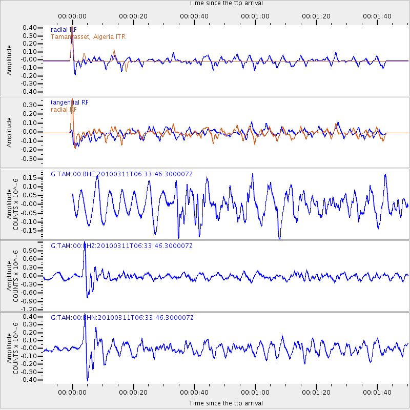
TAM Tamanrasset, Algeria - Earthquake Result Viewer
*The percent match for this event was below the threshold and hence no stack was calculated.
| Earthquake location: |
South Sandwich Islands Region |
| Earthquake latitude/longitude: |
-57.3/-27.9 |
| Earthquake time(UTC): |
2010/03/11 (070) 06:22:18 GMT |
| Earthquake Depth: |
308 km |
| Earthquake Magnitude: |
5.7 MB, 5.6 MW, 5.5 MW |
| Earthquake Catalog/Contributor: |
WHDF/NEIC |
|
| Network: |
G GEOSCOPE |
| Station: |
TAM Tamanrasset, Algeria |
| Lat/Lon: |
22.79 N/5.53 E |
| Elevation: |
1377 m |
|
| Distance: |
84.6 deg |
| Az: |
30.736 deg |
| Baz: |
197.502 deg |
| Ray Param: |
$rayparam |
*The percent match for this event was below the threshold and hence was not used in the summary stack. |
|
| Radial Match: |
60.95462 % |
| Radial Bump: |
307 |
| Transverse Match: |
53.56351 % |
| Transverse Bump: |
400 |
| SOD ConfigId: |
299721 |
| Insert Time: |
2010-04-26 21:42:39.470 +0000 |
| GWidth: |
2.5 |
| Max Bumps: |
400 |
| Tol: |
0.001 |
|
Signal To Noise
| Channel | StoN | STA | LTA |
| G:TAM:00:BHZ:20100311T06:33:46.300007Z | 6.7454004 | 3.884054E-7 | 5.7580777E-8 |
| G:TAM:00:BHN:20100311T06:33:46.300007Z | 4.3088584 | 1.4766061E-7 | 3.426908E-8 |
| G:TAM:00:BHE:20100311T06:33:46.300007Z | 0.9842732 | 6.455474E-8 | 6.55862E-8 |
| Arrivals |
| Ps | |
| PpPs | |
| PsPs/PpSs | |


