You are here: Home > Network List > AV - Alaska Volcano Observatory Stations List
> Station MAPS Pakushin Southeast, Makushin Volcano, Alaska > Earthquake Result Viewer
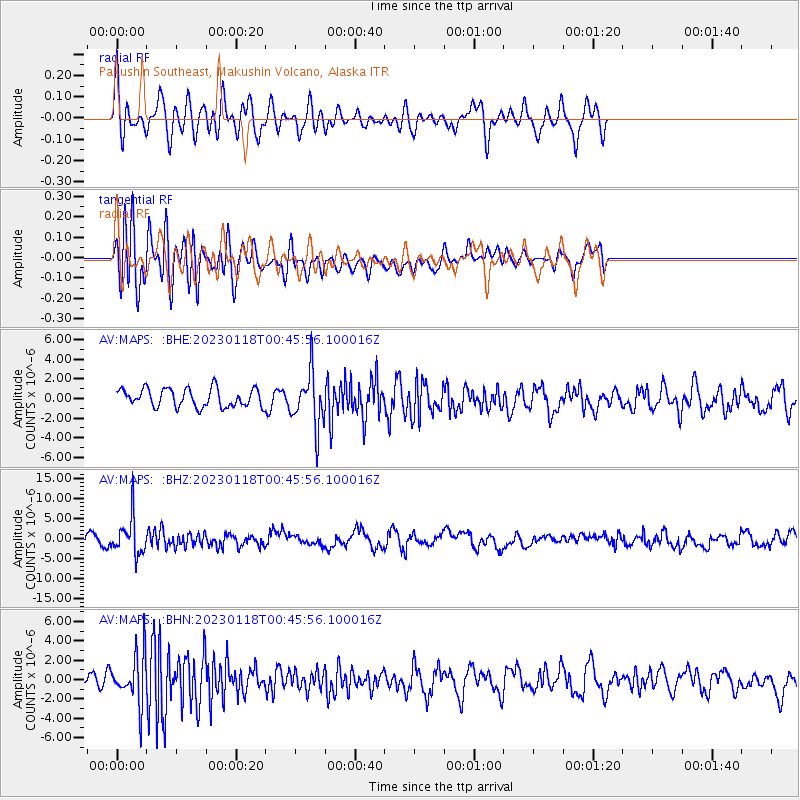
MAPS Pakushin Southeast, Makushin Volcano, Alaska - Earthquake Result Viewer
*The percent match for this event was below the threshold and hence no stack was calculated.
| Earthquake location: |
Minahassa Peninsula, Sulawesi |
| Earthquake latitude/longitude: |
-0.0/123.2 |
| Earthquake time(UTC): |
2023/01/18 (018) 00:34:43 GMT |
| Earthquake Depth: |
147 km |
| Earthquake Magnitude: |
6.1 mww |
| Earthquake Catalog/Contributor: |
NEIC PDE/us |
|
| Network: |
AV Alaska Volcano Observatory |
| Station: |
MAPS Pakushin Southeast, Makushin Volcano, Alaska |
| Lat/Lon: |
53.81 N/166.94 W |
| Elevation: |
333 m |
|
| Distance: |
78.3 deg |
| Az: |
34.664 deg |
| Baz: |
253.54 deg |
| Ray Param: |
$rayparam |
*The percent match for this event was below the threshold and hence was not used in the summary stack. |
|
| Radial Match: |
57.34622 % |
| Radial Bump: |
358 |
| Transverse Match: |
47.340576 % |
| Transverse Bump: |
400 |
| SOD ConfigId: |
29823551 |
| Insert Time: |
2023-02-01 00:42:15.877 +0000 |
| GWidth: |
2.5 |
| Max Bumps: |
400 |
| Tol: |
0.001 |
|
Signal To Noise
| Channel | StoN | STA | LTA |
| AV:MAPS: :BHZ:20230118T00:45:56.100016Z | 2.702772 | 4.6576324E-6 | 1.7232799E-6 |
| AV:MAPS: :BHN:20230118T00:45:56.100016Z | 2.6329217 | 2.5799366E-6 | 9.79876E-7 |
| AV:MAPS: :BHE:20230118T00:45:56.100016Z | 2.9241474 | 2.7176488E-6 | 9.2938166E-7 |
| Arrivals |
| Ps | |
| PpPs | |
| PsPs/PpSs | |


