FRD AZ.FRD - Earthquake Result Viewer
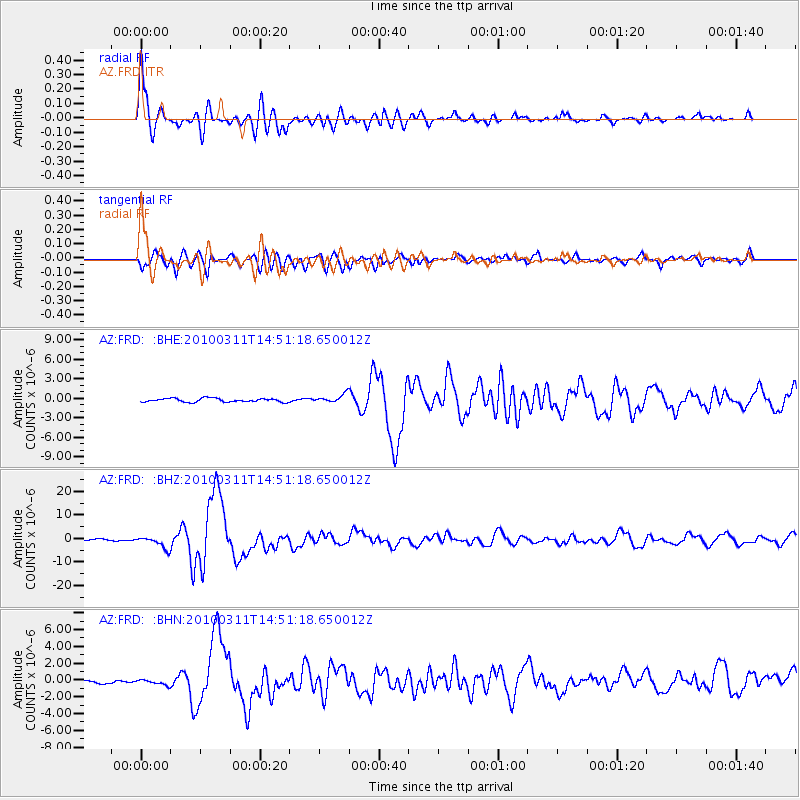
Earthquake location: Near Coast Of Central Chile
Earthquake latitude/longitude: -34.3/-71.9
Earthquake time(UTC): 2010/03/11 (070) 14:39:43 GMT
Earthquake Depth: 11 km
Earthquake Magnitude: 6.7 MB, 7.0 MS, 6.9 MW, 6.9 MW
Earthquake Catalog/Contributor: WHDF/NEIC
Network: AZ ANZA Regional Network
Station: FRD AZ.FRD
Lat/Lon: 33.49 N/116.60 W
Elevation: 1164 m
Distance: 79.4 deg
Az: 323.268 deg
Baz: 143.66 deg
Ray Param: 0.048972838
Estimated Moho Depth: 26.5 km
Estimated Crust Vp/Vs: 1.81
Assumed Crust Vp: 6.264 km/s
Estimated Crust Vs: 3.47 km/s
Estimated Crust Poisson's Ratio: 0.28
Radial Match: 94.99581 %
Radial Bump: 400
Transverse Match: 84.32001 %
Transverse Bump: 400
SOD ConfigId: 299721
Insert Time: 2010-04-26 21:44:40.598 +0000
GWidth: 2.5
Max Bumps: 400
Tol: 0.001

Signal To Noise

ChannelStoNSTALTA
AZ:FRD: :BHZ:20100311T14:51:18.650012Z9.6299822.516869E-62.613576E-7
AZ:FRD: :BHN:20100311T14:51:18.650012Z1.24364893.164219E-72.5443023E-7
AZ:FRD: :BHE:20100311T14:51:18.650012Z2.31735546.5056093E-72.807342E-7
Arrivals
Ps3.5 SECOND
PpPs12 SECOND
PsPs/PpSs15 SECOND