
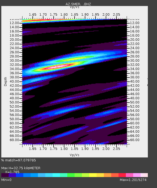
SMER AZ.SMER - Earthquake Result Viewer
| ||||||||||||||||||
| ||||||||||||||||||
| ||||||||||||||||||
|
Signal To Noise
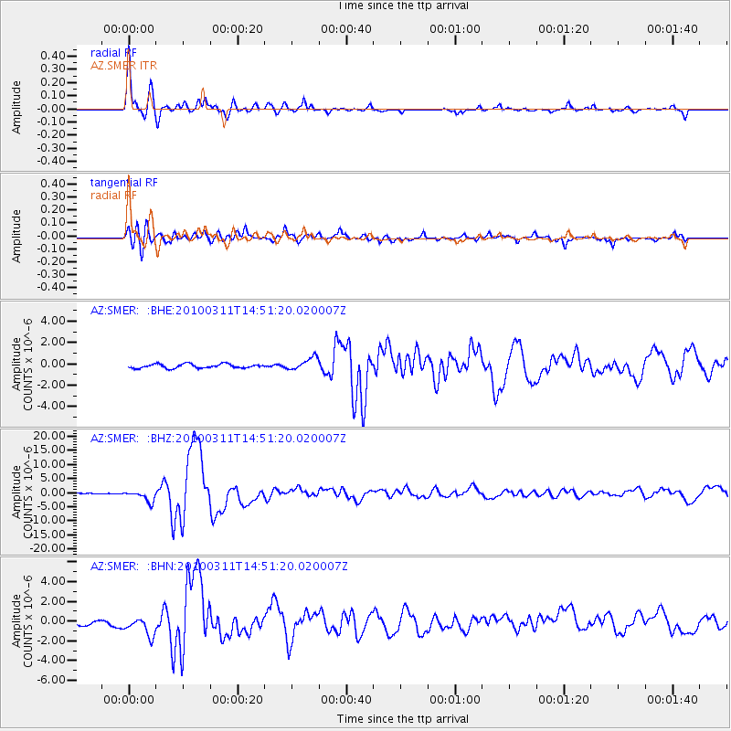
| Channel | StoN | STA | LTA |
| AZ:SMER: :BHZ:20100311T14:51:20.020007Z | 6.6496835 | 2.006531E-6 | 3.0174837E-7 |
| AZ:SMER: :BHN:20100311T14:51:20.020007Z | 2.9444528 | 1.008012E-6 | 3.4234273E-7 |
| AZ:SMER: :BHE:20100311T14:51:20.020007Z | 3.0081682 | 5.8497307E-7 | 1.9446156E-7 |
| Arrivals | |
| Ps | 4.1 SECOND |
| PpPs | 14 SECOND |
| PsPs/PpSs | 18 SECOND |

