TAM Tamanrasset, Algeria - Earthquake Result Viewer
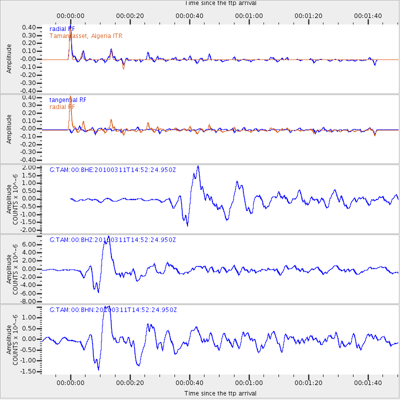
Earthquake location: Near Coast Of Central Chile
Earthquake latitude/longitude: -34.3/-71.9
Earthquake time(UTC): 2010/03/11 (070) 14:39:43 GMT
Earthquake Depth: 11 km
Earthquake Magnitude: 6.7 MB, 7.0 MS, 6.9 MW, 6.9 MW
Earthquake Catalog/Contributor: WHDF/NEIC
Network: G GEOSCOPE
Station: TAM Tamanrasset, Algeria
Lat/Lon: 22.79 N/5.53 E
Elevation: 1377 m
Distance: 92.8 deg
Az: 64.395 deg
Baz: 234.004 deg
Ray Param: 0.04137844
Estimated Moho Depth: 32.25 km
Estimated Crust Vp/Vs: 1.87
Assumed Crust Vp: 6.61 km/s
Estimated Crust Vs: 3.539 km/s
Estimated Crust Poisson's Ratio: 0.30
Radial Match: 97.529144 %
Radial Bump: 280
Transverse Match: 83.95267 %
Transverse Bump: 400
SOD ConfigId: 299721
Insert Time: 2010-04-26 21:51:13.948 +0000
GWidth: 2.5
Max Bumps: 400
Tol: 0.001

Signal To Noise

ChannelStoNSTALTA
G:TAM:00:BHZ:20100311T14:52:24.950Z6.8746087.559775E-71.09966635E-7
G:TAM:00:BHN:20100311T14:52:24.950Z2.98277191.7280604E-75.7934713E-8
G:TAM:00:BHE:20100311T14:52:24.950Z3.32698182.0285577E-76.0972916E-8
Arrivals
Ps4.3 SECOND
PpPs14 SECOND
PsPs/PpSs18 SECOND