You are here: Home > Network List > XA95 - Missouri to Massachusetts Transect Stations List
> Station MM18 Tyson, Missiouri > Earthquake Result Viewer
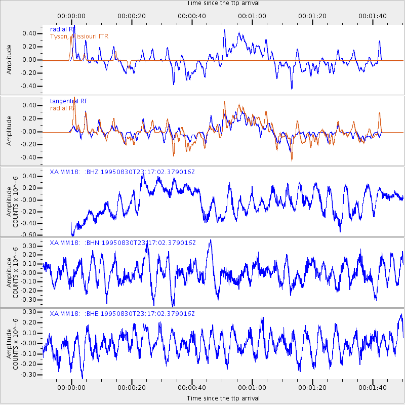
MM18 Tyson, Missiouri - Earthquake Result Viewer
*The percent match for this event was below the threshold and hence no stack was calculated.
| Earthquake location: |
Tonga Islands |
| Earthquake latitude/longitude: |
-19.3/-173.6 |
| Earthquake time(UTC): |
1995/08/30 (242) 23:04:07 GMT |
| Earthquake Depth: |
33 km |
| Earthquake Magnitude: |
5.8 MS, 5.1 MB, 5.8 UNKNOWN, 5.8 MW |
| Earthquake Catalog/Contributor: |
WHDF/NEIC |
|
| Network: |
XA Missouri to Massachusetts Transect |
| Station: |
MM18 Tyson, Missiouri |
| Lat/Lon: |
38.53 N/90.57 W |
| Elevation: |
186 m |
|
| Distance: |
96.5 deg |
| Az: |
51.583 deg |
| Baz: |
250.643 deg |
| Ray Param: |
$rayparam |
*The percent match for this event was below the threshold and hence was not used in the summary stack. |
|
| Radial Match: |
34.20468 % |
| Radial Bump: |
400 |
| Transverse Match: |
27.895115 % |
| Transverse Bump: |
400 |
| SOD ConfigId: |
4480 |
| Insert Time: |
2010-02-26 17:57:36.799 +0000 |
| GWidth: |
2.5 |
| Max Bumps: |
400 |
| Tol: |
0.001 |
|
Signal To Noise
| Channel | StoN | STA | LTA |
| XA:MM18: :BHN:19950830T23:17:02.379016Z | 0.859231 | 1.02245615E-7 | 1.1899665E-7 |
| XA:MM18: :BHE:19950830T23:17:02.379016Z | 1.5760955 | 1.9175384E-7 | 1.2166385E-7 |
| XA:MM18: :BHZ:19950830T23:17:02.379016Z | 1.8878347 | 4.219727E-7 | 2.2352205E-7 |
| Arrivals |
| Ps | |
| PpPs | |
| PsPs/PpSs | |


