You are here: Home > Network List > XA95 - Missouri to Massachusetts Transect Stations List
> Station MM18 Tyson, Missiouri > Earthquake Result Viewer
MM18 Tyson, Missiouri - Earthquake Result Viewer
*The percent match for this event was below the threshold and hence no stack was calculated.
| Earthquake location: |
Southern East Pacific Rise |
| Earthquake latitude/longitude: |
-56.2/-122.4 |
| Earthquake time(UTC): |
1995/09/08 (251) 01:15:28 GMT |
| Earthquake Depth: |
10 km |
| Earthquake Magnitude: |
5.2 MB, 6.3 MS, 6.3 UNKNOWN, 6.3 MW |
| Earthquake Catalog/Contributor: |
WHDF/NEIC |
|
| Network: |
XA Missouri to Massachusetts Transect |
| Station: |
MM18 Tyson, Missiouri |
| Lat/Lon: |
38.53 N/90.57 W |
| Elevation: |
186 m |
|
| Distance: |
98.1 deg |
| Az: |
24.688 deg |
| Baz: |
197.331 deg |
| Ray Param: |
$rayparam |
*The percent match for this event was below the threshold and hence was not used in the summary stack. |
|
| Radial Match: |
61.806583 % |
| Radial Bump: |
400 |
| Transverse Match: |
54.217712 % |
| Transverse Bump: |
400 |
| SOD ConfigId: |
4480 |
| Insert Time: |
2010-02-26 17:57:37.828 +0000 |
| GWidth: |
2.5 |
| Max Bumps: |
400 |
| Tol: |
0.001 |
|
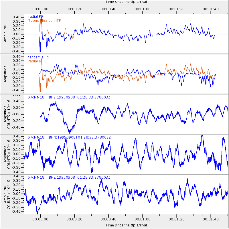
Signal To Noise
| Channel | StoN | STA | LTA |
| XA:MM18: :BHN:19950908T01:28:33.378003Z | 1.0730418 | 1.8585744E-7 | 1.7320616E-7 |
| XA:MM18: :BHE:19950908T01:28:33.378003Z | 1.8099711 | 2.3473625E-7 | 1.296906E-7 |
| XA:MM18: :BHZ:19950908T01:28:33.378003Z | 0.55880326 | 1.4725903E-7 | 2.635257E-7 |
| Arrivals |
| Ps | |
| PpPs | |
| PsPs/PpSs | |


