You are here: Home > Network List > XA95 - Missouri to Massachusetts Transect Stations List
> Station MM18 Tyson, Missiouri > Earthquake Result Viewer
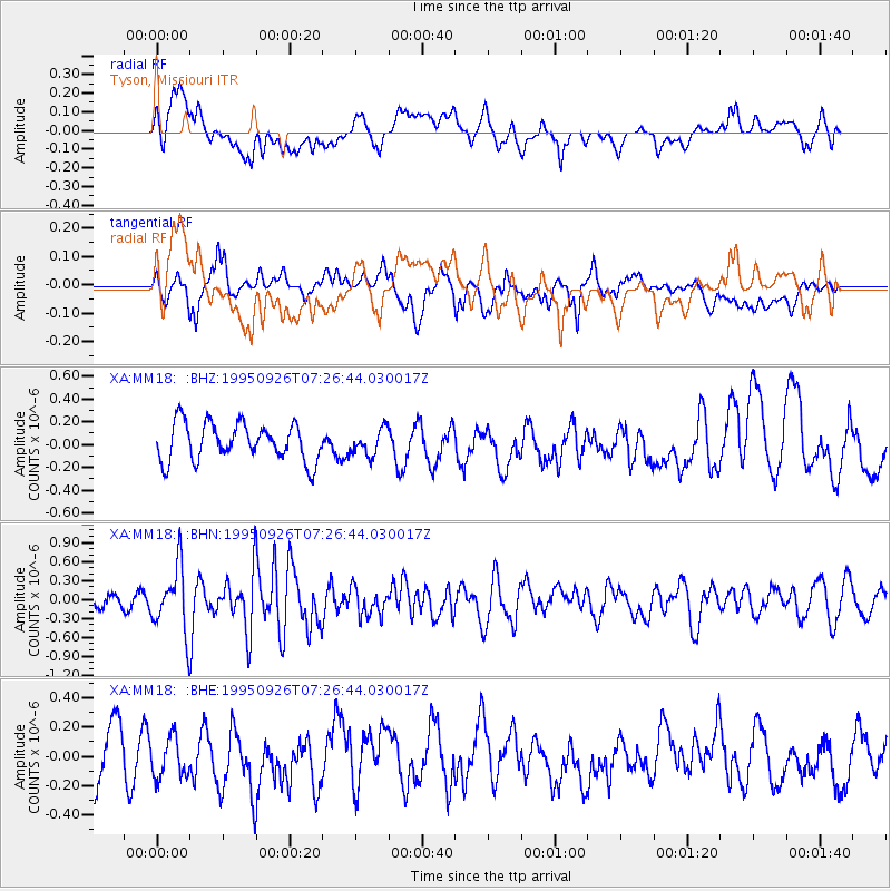
MM18 Tyson, Missiouri - Earthquake Result Viewer
*The percent match for this event was below the threshold and hence no stack was calculated.
| Earthquake location: |
Hokkaido, Japan Region |
| Earthquake latitude/longitude: |
41.8/143.4 |
| Earthquake time(UTC): |
1995/09/26 (269) 07:14:37 GMT |
| Earthquake Depth: |
36 km |
| Earthquake Magnitude: |
5.7 MB, 5.5 MS, 5.9 UNKNOWN, 5.8 MW |
| Earthquake Catalog/Contributor: |
WHDF/NEIC |
|
| Network: |
XA Missouri to Massachusetts Transect |
| Station: |
MM18 Tyson, Missiouri |
| Lat/Lon: |
38.53 N/90.57 W |
| Elevation: |
186 m |
|
| Distance: |
86.2 deg |
| Az: |
39.464 deg |
| Baz: |
322.702 deg |
| Ray Param: |
$rayparam |
*The percent match for this event was below the threshold and hence was not used in the summary stack. |
|
| Radial Match: |
49.426865 % |
| Radial Bump: |
400 |
| Transverse Match: |
58.91866 % |
| Transverse Bump: |
400 |
| SOD ConfigId: |
4480 |
| Insert Time: |
2010-02-26 17:57:43.020 +0000 |
| GWidth: |
2.5 |
| Max Bumps: |
400 |
| Tol: |
0.001 |
|
Signal To Noise
| Channel | StoN | STA | LTA |
| XA:MM18: :BHN:19950926T07:26:44.030017Z | 4.2718635 | 5.2786515E-7 | 1.235679E-7 |
| XA:MM18: :BHE:19950926T07:26:44.030017Z | 0.93382037 | 1.5608678E-7 | 1.6714861E-7 |
| XA:MM18: :BHZ:19950926T07:26:44.030017Z | 0.6993905 | 1.1565359E-7 | 1.653634E-7 |
| Arrivals |
| Ps | |
| PpPs | |
| PsPs/PpSs | |


