You are here: Home > Network List > GS - US Geological Survey Networks Stations List
> Station OK051 E0350 and S34600 roads, Ralston OK > Earthquake Result Viewer
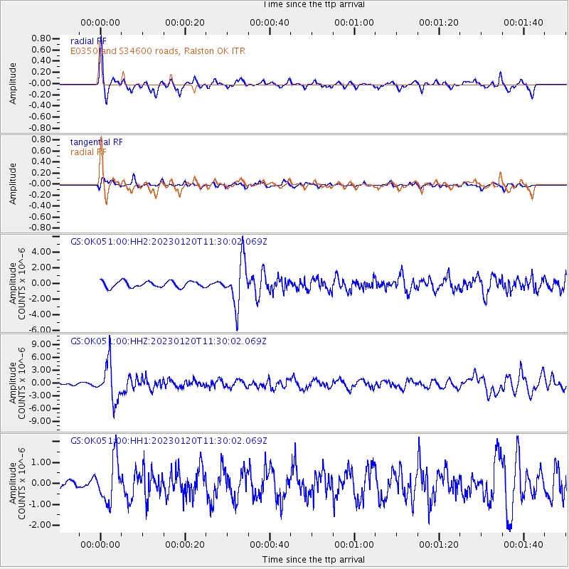
OK051 E0350 and S34600 roads, Ralston OK - Earthquake Result Viewer
*The percent match for this event was below the threshold and hence no stack was calculated.
| Earthquake location: |
Leeward Islands |
| Earthquake latitude/longitude: |
16.2/-62.0 |
| Earthquake time(UTC): |
2023/01/20 (020) 11:23:40 GMT |
| Earthquake Depth: |
165 km |
| Earthquake Magnitude: |
5.8 Mi |
| Earthquake Catalog/Contributor: |
NEIC PDE/pt |
|
| Network: |
GS US Geological Survey Networks |
| Station: |
OK051 E0350 and S34600 roads, Ralston OK |
| Lat/Lon: |
36.50 N/96.84 W |
| Elevation: |
263 m |
|
| Distance: |
36.9 deg |
| Az: |
309.934 deg |
| Baz: |
113.909 deg |
| Ray Param: |
$rayparam |
*The percent match for this event was below the threshold and hence was not used in the summary stack. |
|
| Radial Match: |
77.22413 % |
| Radial Bump: |
315 |
| Transverse Match: |
61.85389 % |
| Transverse Bump: |
400 |
| SOD ConfigId: |
29823551 |
| Insert Time: |
2023-02-03 11:42:29.680 +0000 |
| GWidth: |
2.5 |
| Max Bumps: |
400 |
| Tol: |
0.001 |
|
Signal To Noise
| Channel | StoN | STA | LTA |
| GS:OK051:00:HHZ:20230120T11:30:02.069Z | 6.684718 | 4.3733917E-6 | 6.542372E-7 |
| GS:OK051:00:HH1:20230120T11:30:02.069Z | 1.4664156 | 1.0317597E-6 | 7.0359295E-7 |
| GS:OK051:00:HH2:20230120T11:30:02.069Z | 7.270054 | 2.892046E-6 | 3.9780255E-7 |
| Arrivals |
| Ps | |
| PpPs | |
| PsPs/PpSs | |


