You are here: Home > Network List > IW - Intermountain West Stations List
> Station PLID Pearl Lake, Idaho, USA > Earthquake Result Viewer
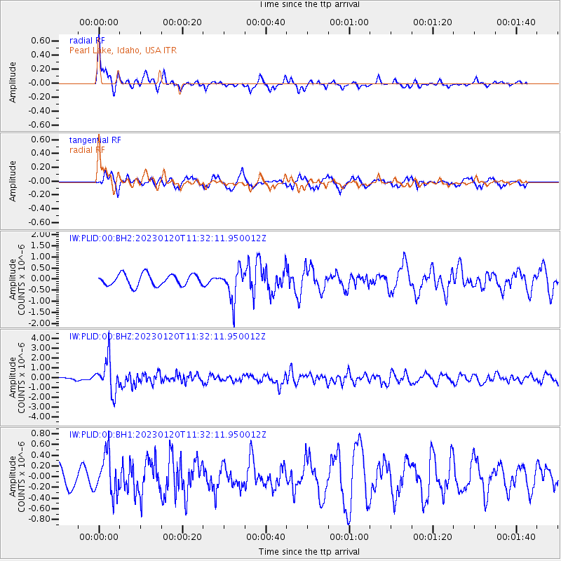
PLID Pearl Lake, Idaho, USA - Earthquake Result Viewer
*The percent match for this event was below the threshold and hence no stack was calculated.
| Earthquake location: |
Leeward Islands |
| Earthquake latitude/longitude: |
16.2/-62.0 |
| Earthquake time(UTC): |
2023/01/20 (020) 11:23:40 GMT |
| Earthquake Depth: |
165 km |
| Earthquake Magnitude: |
5.8 Mi |
| Earthquake Catalog/Contributor: |
NEIC PDE/pt |
|
| Network: |
IW Intermountain West |
| Station: |
PLID Pearl Lake, Idaho, USA |
| Lat/Lon: |
45.09 N/116.00 W |
| Elevation: |
2164 m |
|
| Distance: |
53.4 deg |
| Az: |
314.457 deg |
| Baz: |
104.558 deg |
| Ray Param: |
$rayparam |
*The percent match for this event was below the threshold and hence was not used in the summary stack. |
|
| Radial Match: |
59.46936 % |
| Radial Bump: |
369 |
| Transverse Match: |
63.826912 % |
| Transverse Bump: |
375 |
| SOD ConfigId: |
29823551 |
| Insert Time: |
2023-02-03 11:44:18.095 +0000 |
| GWidth: |
2.5 |
| Max Bumps: |
400 |
| Tol: |
0.001 |
|
Signal To Noise
| Channel | StoN | STA | LTA |
| IW:PLID:00:BHZ:20230120T11:32:11.950012Z | 8.026746 | 1.7202457E-6 | 2.1431421E-7 |
| IW:PLID:00:BH1:20230120T11:32:11.950012Z | 1.1832875 | 3.821263E-7 | 3.2293616E-7 |
| IW:PLID:00:BH2:20230120T11:32:11.950012Z | 2.7138803 | 6.9885505E-7 | 2.5751137E-7 |
| Arrivals |
| Ps | |
| PpPs | |
| PsPs/PpSs | |


