You are here: Home > Network List > TA - USArray Transportable Network (new EarthScope stations) Stations List
> Station J21A Lysite, WY, USA > Earthquake Result Viewer
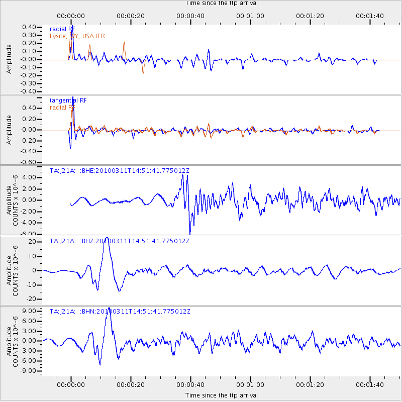
J21A Lysite, WY, USA - Earthquake Result Viewer
*The percent match for this event was below the threshold and hence no stack was calculated.
| Earthquake location: |
Near Coast Of Central Chile |
| Earthquake latitude/longitude: |
-34.3/-71.9 |
| Earthquake time(UTC): |
2010/03/11 (070) 14:39:43 GMT |
| Earthquake Depth: |
11 km |
| Earthquake Magnitude: |
6.7 MB, 7.0 MS, 6.9 MW, 6.9 MW |
| Earthquake Catalog/Contributor: |
WHDF/NEIC |
|
| Network: |
TA USArray Transportable Network (new EarthScope stations) |
| Station: |
J21A Lysite, WY, USA |
| Lat/Lon: |
43.35 N/107.45 W |
| Elevation: |
1913 m |
|
| Distance: |
83.8 deg |
| Az: |
334.742 deg |
| Baz: |
151.036 deg |
| Ray Param: |
$rayparam |
*The percent match for this event was below the threshold and hence was not used in the summary stack. |
|
| Radial Match: |
90.54265 % |
| Radial Bump: |
400 |
| Transverse Match: |
78.44838 % |
| Transverse Bump: |
400 |
| SOD ConfigId: |
299721 |
| Insert Time: |
2010-04-26 22:05:16.144 +0000 |
| GWidth: |
2.5 |
| Max Bumps: |
400 |
| Tol: |
0.001 |
|
Signal To Noise
| Channel | StoN | STA | LTA |
| TA:J21A: :BHZ:20100311T14:51:41.775012Z | 5.3637686 | 2.2058248E-6 | 4.112453E-7 |
| TA:J21A: :BHN:20100311T14:51:41.775012Z | 3.8372877 | 1.6041273E-6 | 4.1803676E-7 |
| TA:J21A: :BHE:20100311T14:51:41.775012Z | 1.9000514 | 7.523629E-7 | 3.9596975E-7 |
| Arrivals |
| Ps | |
| PpPs | |
| PsPs/PpSs | |


