You are here: Home > Network List > US - United States National Seismic Network Stations List
> Station HAWA Hanford, Washington, USA > Earthquake Result Viewer
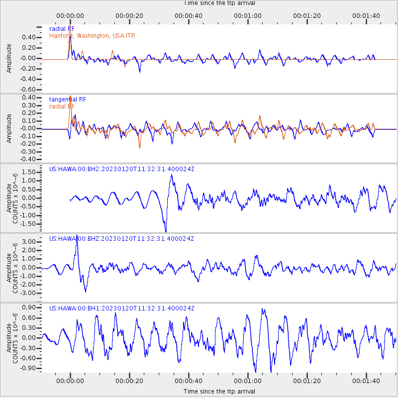
HAWA Hanford, Washington, USA - Earthquake Result Viewer
*The percent match for this event was below the threshold and hence no stack was calculated.
| Earthquake location: |
Leeward Islands |
| Earthquake latitude/longitude: |
16.2/-62.0 |
| Earthquake time(UTC): |
2023/01/20 (020) 11:23:40 GMT |
| Earthquake Depth: |
165 km |
| Earthquake Magnitude: |
5.8 Mi |
| Earthquake Catalog/Contributor: |
NEIC PDE/pt |
|
| Network: |
US United States National Seismic Network |
| Station: |
HAWA Hanford, Washington, USA |
| Lat/Lon: |
46.39 N/119.53 W |
| Elevation: |
364 m |
|
| Distance: |
56.1 deg |
| Az: |
315.301 deg |
| Baz: |
102.523 deg |
| Ray Param: |
$rayparam |
*The percent match for this event was below the threshold and hence was not used in the summary stack. |
|
| Radial Match: |
64.17858 % |
| Radial Bump: |
400 |
| Transverse Match: |
58.11201 % |
| Transverse Bump: |
400 |
| SOD ConfigId: |
29823551 |
| Insert Time: |
2023-02-03 11:57:45.290 +0000 |
| GWidth: |
2.5 |
| Max Bumps: |
400 |
| Tol: |
0.001 |
|
Signal To Noise
| Channel | StoN | STA | LTA |
| US:HAWA:00:BHZ:20230120T11:32:31.400024Z | 5.8001456 | 1.472545E-6 | 2.538807E-7 |
| US:HAWA:00:BH1:20230120T11:32:31.400024Z | 0.9278557 | 2.7873762E-7 | 3.0041053E-7 |
| US:HAWA:00:BH2:20230120T11:32:31.400024Z | 4.9770646 | 9.673113E-7 | 1.9435376E-7 |
| Arrivals |
| Ps | |
| PpPs | |
| PsPs/PpSs | |


