You are here: Home > Network List > TA - USArray Transportable Network (new EarthScope stations) Stations List
> Station H19A Powell, WY, USA > Earthquake Result Viewer
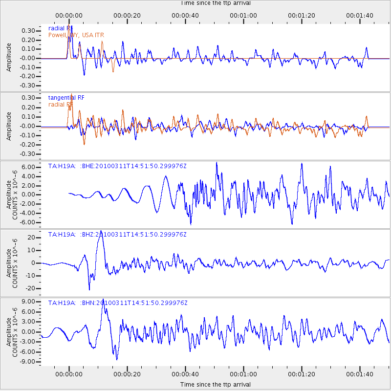
H19A Powell, WY, USA - Earthquake Result Viewer

| Earthquake location: |
Near Coast Of Central Chile |
| Earthquake latitude/longitude: |
-34.3/-71.9 |
| Earthquake time(UTC): |
2010/03/11 (070) 14:39:43 GMT |
| Earthquake Depth: |
11 km |
| Earthquake Magnitude: |
6.7 MB, 7.0 MS, 6.9 MW, 6.9 MW |
| Earthquake Catalog/Contributor: |
WHDF/NEIC |
|
| Network: |
TA USArray Transportable Network (new EarthScope stations) |
| Station: |
H19A Powell, WY, USA |
| Lat/Lon: |
44.67 N/108.99 W |
| Elevation: |
1479 m |
|
| Distance: |
85.5 deg |
| Az: |
334.426 deg |
| Baz: |
149.94 deg |
| Ray Param: |
0.044711445 |
| Estimated Moho Depth: |
10.0 km |
| Estimated Crust Vp/Vs: |
1.70 |
| Assumed Crust Vp: |
6.242 km/s |
| Estimated Crust Vs: |
3.666 km/s |
| Estimated Crust Poisson's Ratio: |
0.24 |
|
| Radial Match: |
80.502266 % |
| Radial Bump: |
400 |
| Transverse Match: |
64.671196 % |
| Transverse Bump: |
400 |
| SOD ConfigId: |
299721 |
| Insert Time: |
2010-04-26 22:06:11.833 +0000 |
| GWidth: |
2.5 |
| Max Bumps: |
400 |
| Tol: |
0.001 |
|
Signal To Noise
| Channel | StoN | STA | LTA |
| TA:H19A: :BHZ:20100311T14:51:50.299976Z | 4.1967444 | 2.3725754E-6 | 5.653371E-7 |
| TA:H19A: :BHN:20100311T14:51:50.299976Z | 1.0985942 | 1.2649264E-6 | 1.1514045E-6 |
| TA:H19A: :BHE:20100311T14:51:50.299976Z | 3.7424154 | 2.750545E-6 | 7.3496517E-7 |
| Arrivals |
| Ps | 1.2 SECOND |
| PpPs | 4.2 SECOND |
| PsPs/PpSs | 5.4 SECOND |


