You are here: Home > Network List > US - United States National Seismic Network Stations List
> Station MSO Missoula, Montana, USA > Earthquake Result Viewer
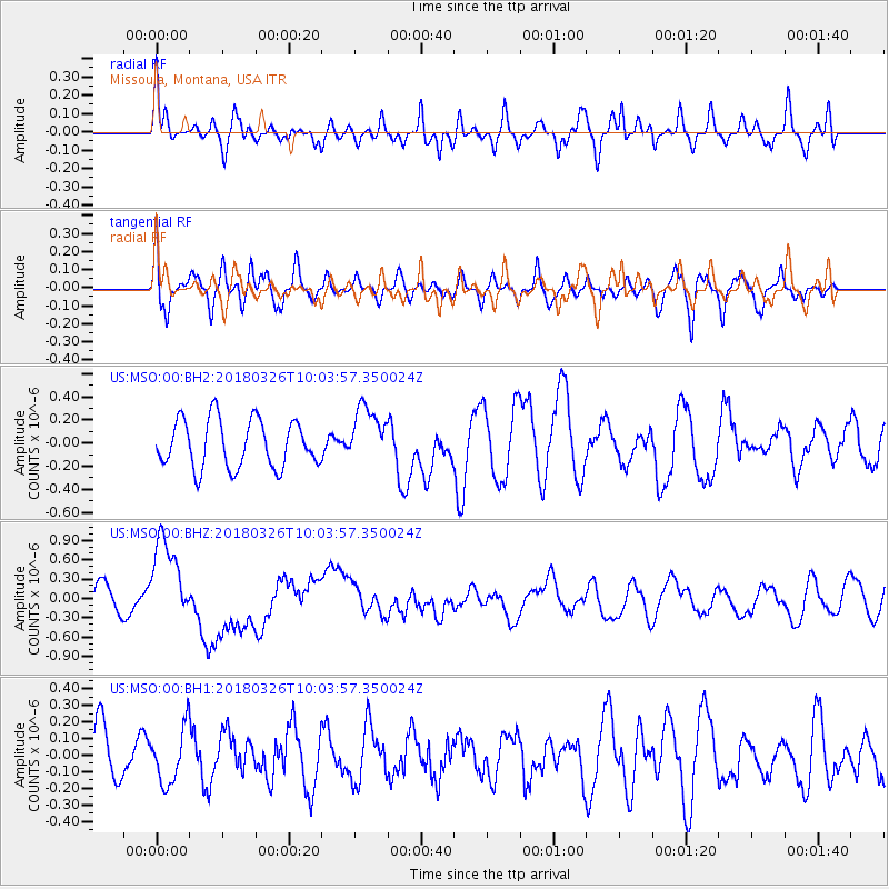
MSO Missoula, Montana, USA - Earthquake Result Viewer
*The percent match for this event was below the threshold and hence no stack was calculated.
| Earthquake location: |
New Britain Region, P.N.G. |
| Earthquake latitude/longitude: |
-5.5/151.4 |
| Earthquake time(UTC): |
2018/03/26 (085) 09:51:00 GMT |
| Earthquake Depth: |
40 km |
| Earthquake Magnitude: |
6.6 mww |
| Earthquake Catalog/Contributor: |
NEIC PDE/us |
|
| Network: |
US United States National Seismic Network |
| Station: |
MSO Missoula, Montana, USA |
| Lat/Lon: |
46.83 N/113.94 W |
| Elevation: |
1264 m |
|
| Distance: |
97.1 deg |
| Az: |
43.606 deg |
| Baz: |
269.649 deg |
| Ray Param: |
$rayparam |
*The percent match for this event was below the threshold and hence was not used in the summary stack. |
|
| Radial Match: |
59.209534 % |
| Radial Bump: |
400 |
| Transverse Match: |
52.624523 % |
| Transverse Bump: |
400 |
| SOD ConfigId: |
2973751 |
| Insert Time: |
2018-10-09 10:15:43.912 +0000 |
| GWidth: |
2.5 |
| Max Bumps: |
400 |
| Tol: |
0.001 |
|
Signal To Noise
| Channel | StoN | STA | LTA |
| US:MSO:00:BHZ:20180326T10:03:57.350024Z | 2.7605598 | 6.859136E-7 | 2.4846904E-7 |
| US:MSO:00:BH1:20180326T10:03:57.350024Z | 0.538897 | 1.6692209E-7 | 3.097477E-7 |
| US:MSO:00:BH2:20180326T10:03:57.350024Z | 1.2064623 | 2.4821898E-7 | 2.057412E-7 |
| Arrivals |
| Ps | |
| PpPs | |
| PsPs/PpSs | |


