You are here: Home > Network List > CI - Caltech Regional Seismic Network Stations List
> Station SWS Sam W. Stewart, Westmorland, CA, USA > Earthquake Result Viewer
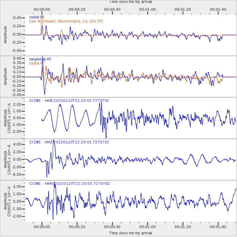
SWS Sam W. Stewart, Westmorland, CA, USA - Earthquake Result Viewer
*The percent match for this event was below the threshold and hence no stack was calculated.
| Earthquake location: |
Santiago Del Estero Prov., Arg. |
| Earthquake latitude/longitude: |
-26.7/-63.0 |
| Earthquake time(UTC): |
2023/01/20 (020) 22:09:39 GMT |
| Earthquake Depth: |
611 km |
| Earthquake Magnitude: |
6.8 mww |
| Earthquake Catalog/Contributor: |
NEIC PDE/us |
|
| Network: |
CI Caltech Regional Seismic Network |
| Station: |
SWS Sam W. Stewart, Westmorland, CA, USA |
| Lat/Lon: |
32.94 N/115.80 W |
| Elevation: |
140 m |
|
| Distance: |
77.7 deg |
| Az: |
316.752 deg |
| Baz: |
133.217 deg |
| Ray Param: |
$rayparam |
*The percent match for this event was below the threshold and hence was not used in the summary stack. |
|
| Radial Match: |
64.534615 % |
| Radial Bump: |
400 |
| Transverse Match: |
62.52148 % |
| Transverse Bump: |
400 |
| SOD ConfigId: |
29823551 |
| Insert Time: |
2023-02-03 22:16:30.734 +0000 |
| GWidth: |
2.5 |
| Max Bumps: |
400 |
| Tol: |
0.001 |
|
Signal To Noise
| Channel | StoN | STA | LTA |
| CI:SWS: :HHZ:20230120T22:20:03.727979Z | 3.0273602 | 1.5576488E-6 | 5.145238E-7 |
| CI:SWS: :HHN:20230120T22:20:03.727979Z | 1.3447969 | 6.4074396E-7 | 4.764615E-7 |
| CI:SWS: :HHE:20230120T22:20:03.727979Z | 1.0183709 | 1.1487547E-6 | 1.1280317E-6 |
| Arrivals |
| Ps | |
| PpPs | |
| PsPs/PpSs | |


