You are here: Home > Network List > TA - USArray Transportable Network (new EarthScope stations) Stations List
> Station 432A Menard, TX, USA > Earthquake Result Viewer
432A Menard, TX, USA - Earthquake Result Viewer

| Earthquake location: |
Near Coast Of Central Chile |
| Earthquake latitude/longitude: |
-34.3/-71.9 |
| Earthquake time(UTC): |
2010/03/11 (070) 14:39:43 GMT |
| Earthquake Depth: |
11 km |
| Earthquake Magnitude: |
6.7 MB, 7.0 MS, 6.9 MW, 6.9 MW |
| Earthquake Catalog/Contributor: |
WHDF/NEIC |
|
| Network: |
TA USArray Transportable Network (new EarthScope stations) |
| Station: |
432A Menard, TX, USA |
| Lat/Lon: |
30.88 N/99.79 W |
| Elevation: |
647 m |
|
| Distance: |
70.0 deg |
| Az: |
334.64 deg |
| Baz: |
155.642 deg |
| Ray Param: |
0.055300754 |
| Estimated Moho Depth: |
42.25 km |
| Estimated Crust Vp/Vs: |
1.61 |
| Assumed Crust Vp: |
6.498 km/s |
| Estimated Crust Vs: |
4.029 km/s |
| Estimated Crust Poisson's Ratio: |
0.19 |
|
| Radial Match: |
96.11636 % |
| Radial Bump: |
400 |
| Transverse Match: |
89.66794 % |
| Transverse Bump: |
400 |
| SOD ConfigId: |
299721 |
| Insert Time: |
2010-04-26 22:16:40.121 +0000 |
| GWidth: |
2.5 |
| Max Bumps: |
400 |
| Tol: |
0.001 |
|
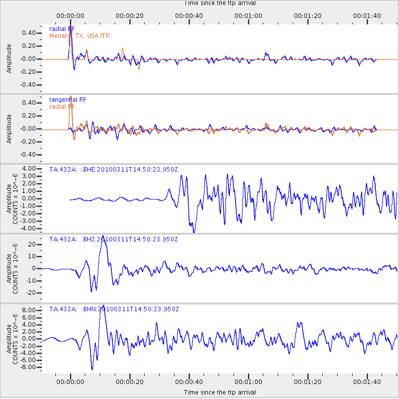
Signal To Noise
| Channel | StoN | STA | LTA |
| TA:432A: :BHZ:20100311T14:50:23.950Z | 11.099004 | 2.790599E-6 | 2.5142788E-7 |
| TA:432A: :BHN:20100311T14:50:23.950Z | 4.455842 | 1.1333385E-6 | 2.543489E-7 |
| TA:432A: :BHE:20100311T14:50:23.950Z | 4.003797 | 5.376482E-7 | 1.3428456E-7 |
| Arrivals |
| Ps | 4.2 SECOND |
| PpPs | 16 SECOND |
| PsPs/PpSs | 20 SECOND |


