You are here: Home > Network List > US - United States National Seismic Network Stations List
> Station MNTX Cornudas Mountains, Texas, USA > Earthquake Result Viewer
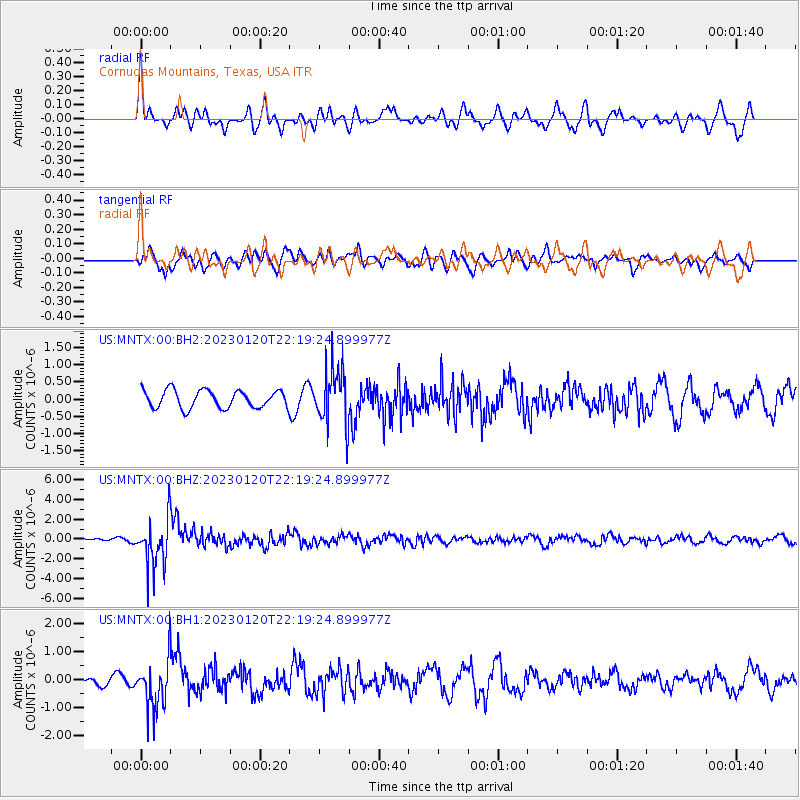
MNTX Cornudas Mountains, Texas, USA - Earthquake Result Viewer
*The percent match for this event was below the threshold and hence no stack was calculated.
| Earthquake location: |
Santiago Del Estero Prov., Arg. |
| Earthquake latitude/longitude: |
-26.7/-63.0 |
| Earthquake time(UTC): |
2023/01/20 (020) 22:09:39 GMT |
| Earthquake Depth: |
611 km |
| Earthquake Magnitude: |
6.8 mww |
| Earthquake Catalog/Contributor: |
NEIC PDE/us |
|
| Network: |
US United States National Seismic Network |
| Station: |
MNTX Cornudas Mountains, Texas, USA |
| Lat/Lon: |
31.70 N/105.38 W |
| Elevation: |
405 m |
|
| Distance: |
70.8 deg |
| Az: |
322.545 deg |
| Baz: |
140.349 deg |
| Ray Param: |
$rayparam |
*The percent match for this event was below the threshold and hence was not used in the summary stack. |
|
| Radial Match: |
74.99019 % |
| Radial Bump: |
400 |
| Transverse Match: |
67.71198 % |
| Transverse Bump: |
400 |
| SOD ConfigId: |
29823551 |
| Insert Time: |
2023-02-03 22:39:40.006 +0000 |
| GWidth: |
2.5 |
| Max Bumps: |
400 |
| Tol: |
0.001 |
|
Signal To Noise
| Channel | StoN | STA | LTA |
| US:MNTX:00:BHZ:20230120T22:19:24.899977Z | 5.8382473 | 2.4621613E-6 | 4.2172954E-7 |
| US:MNTX:00:BH1:20230120T22:19:24.899977Z | 3.1547697 | 8.920419E-7 | 2.8275977E-7 |
| US:MNTX:00:BH2:20230120T22:19:24.899977Z | 3.1906943 | 8.165951E-7 | 2.5593022E-7 |
| Arrivals |
| Ps | |
| PpPs | |
| PsPs/PpSs | |


