You are here: Home > Network List > US - United States National Seismic Network Stations List
> Station MSO Missoula, Montana, USA > Earthquake Result Viewer
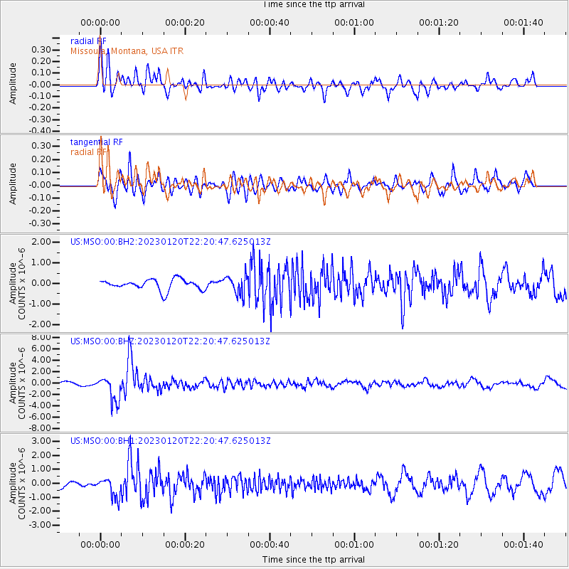
MSO Missoula, Montana, USA - Earthquake Result Viewer
*The percent match for this event was below the threshold and hence no stack was calculated.
| Earthquake location: |
Santiago Del Estero Prov., Arg. |
| Earthquake latitude/longitude: |
-26.7/-63.0 |
| Earthquake time(UTC): |
2023/01/20 (020) 22:09:39 GMT |
| Earthquake Depth: |
611 km |
| Earthquake Magnitude: |
6.8 mww |
| Earthquake Catalog/Contributor: |
NEIC PDE/us |
|
| Network: |
US United States National Seismic Network |
| Station: |
MSO Missoula, Montana, USA |
| Lat/Lon: |
46.83 N/113.94 W |
| Elevation: |
1264 m |
|
| Distance: |
86.4 deg |
| Az: |
327.732 deg |
| Baz: |
135.936 deg |
| Ray Param: |
$rayparam |
*The percent match for this event was below the threshold and hence was not used in the summary stack. |
|
| Radial Match: |
78.41393 % |
| Radial Bump: |
400 |
| Transverse Match: |
72.3252 % |
| Transverse Bump: |
400 |
| SOD ConfigId: |
29823551 |
| Insert Time: |
2023-02-03 22:39:40.360 +0000 |
| GWidth: |
2.5 |
| Max Bumps: |
400 |
| Tol: |
0.001 |
|
Signal To Noise
| Channel | StoN | STA | LTA |
| US:MSO:00:BHZ:20230120T22:20:47.625013Z | 8.6348915 | 2.2404365E-6 | 2.5946318E-7 |
| US:MSO:00:BH1:20230120T22:20:47.625013Z | 2.220298 | 7.1833625E-7 | 3.2353145E-7 |
| US:MSO:00:BH2:20230120T22:20:47.625013Z | 1.7967741 | 4.7023897E-7 | 2.617129E-7 |
| Arrivals |
| Ps | |
| PpPs | |
| PsPs/PpSs | |


