You are here: Home > Network List > UW - Pacific Northwest Regional Seismic Network Stations List
> Station HOOD Mt Hood Meadows, OR CREST BB SMO > Earthquake Result Viewer
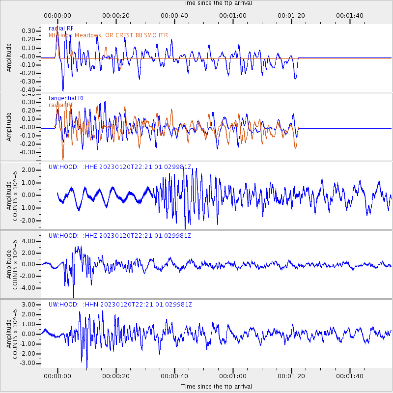
HOOD Mt Hood Meadows, OR CREST BB SMO - Earthquake Result Viewer
*The percent match for this event was below the threshold and hence no stack was calculated.
| Earthquake location: |
Santiago Del Estero Prov., Arg. |
| Earthquake latitude/longitude: |
-26.7/-63.0 |
| Earthquake time(UTC): |
2023/01/20 (020) 22:09:39 GMT |
| Earthquake Depth: |
611 km |
| Earthquake Magnitude: |
6.8 mww |
| Earthquake Catalog/Contributor: |
NEIC PDE/us |
|
| Network: |
UW Pacific Northwest Regional Seismic Network |
| Station: |
HOOD Mt Hood Meadows, OR CREST BB SMO |
| Lat/Lon: |
45.32 N/121.65 W |
| Elevation: |
1520 m |
|
| Distance: |
89.3 deg |
| Az: |
322.964 deg |
| Baz: |
130.218 deg |
| Ray Param: |
$rayparam |
*The percent match for this event was below the threshold and hence was not used in the summary stack. |
|
| Radial Match: |
69.16375 % |
| Radial Bump: |
400 |
| Transverse Match: |
61.554367 % |
| Transverse Bump: |
400 |
| SOD ConfigId: |
29823551 |
| Insert Time: |
2023-02-03 22:41:48.386 +0000 |
| GWidth: |
2.5 |
| Max Bumps: |
400 |
| Tol: |
0.001 |
|
Signal To Noise
| Channel | StoN | STA | LTA |
| UW:HOOD: :HHZ:20230120T22:21:01.029981Z | 5.1800694 | 1.3247168E-6 | 2.557334E-7 |
| UW:HOOD: :HHN:20230120T22:21:01.029981Z | 1.0253868 | 3.362334E-7 | 3.2790885E-7 |
| UW:HOOD: :HHE:20230120T22:21:01.029981Z | 1.0536305 | 4.374436E-7 | 4.1517742E-7 |
| Arrivals |
| Ps | |
| PpPs | |
| PsPs/PpSs | |


