You are here: Home > Network List > IW - Intermountain West Stations List
> Station MOOW Moose Ponds, Wyoming, USA > Earthquake Result Viewer
MOOW Moose Ponds, Wyoming, USA - Earthquake Result Viewer
*The percent match for this event was below the threshold and hence no stack was calculated.
| Earthquake location: |
Reykjanes Ridge |
| Earthquake latitude/longitude: |
57.4/-33.4 |
| Earthquake time(UTC): |
2023/01/21 (021) 19:49:28 GMT |
| Earthquake Depth: |
10 km |
| Earthquake Magnitude: |
5.7 mww |
| Earthquake Catalog/Contributor: |
NEIC PDE/us |
|
| Network: |
IW Intermountain West |
| Station: |
MOOW Moose Ponds, Wyoming, USA |
| Lat/Lon: |
43.75 N/110.74 W |
| Elevation: |
2128 m |
|
| Distance: |
48.3 deg |
| Az: |
288.729 deg |
| Baz: |
45.025 deg |
| Ray Param: |
$rayparam |
*The percent match for this event was below the threshold and hence was not used in the summary stack. |
|
| Radial Match: |
68.79172 % |
| Radial Bump: |
400 |
| Transverse Match: |
62.12657 % |
| Transverse Bump: |
339 |
| SOD ConfigId: |
29823551 |
| Insert Time: |
2023-02-04 20:04:28.993 +0000 |
| GWidth: |
2.5 |
| Max Bumps: |
400 |
| Tol: |
0.001 |
|
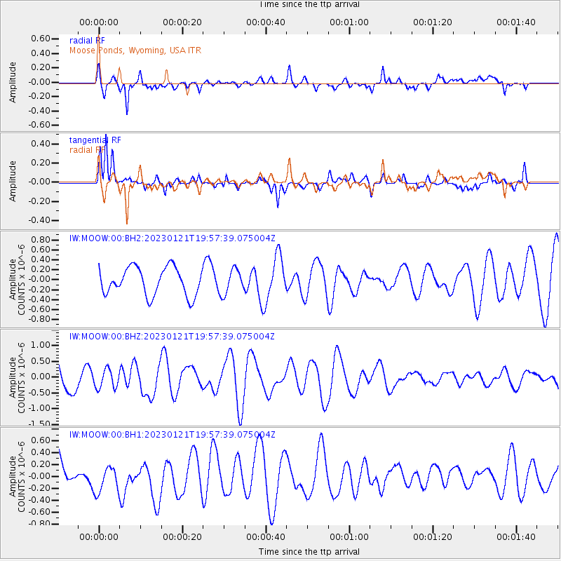
Signal To Noise
| Channel | StoN | STA | LTA |
| IW:MOOW:00:BHZ:20230121T19:57:39.075004Z | 0.73133373 | 3.009296E-7 | 4.1148056E-7 |
| IW:MOOW:00:BH1:20230121T19:57:39.075004Z | 0.8424939 | 2.46732E-7 | 2.9285908E-7 |
| IW:MOOW:00:BH2:20230121T19:57:39.075004Z | 0.9000015 | 2.487364E-7 | 2.7637333E-7 |
| Arrivals |
| Ps | |
| PpPs | |
| PsPs/PpSs | |


