You are here: Home > Network List > US - United States National Seismic Network Stations List
> Station WMOK Wichita Mountains, Oklahoma, USA > Earthquake Result Viewer
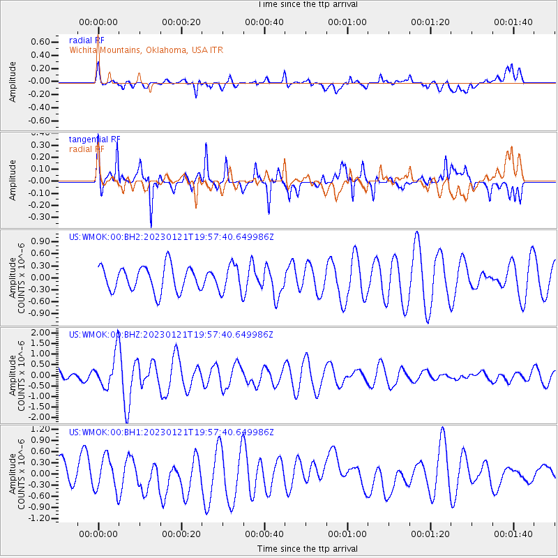
WMOK Wichita Mountains, Oklahoma, USA - Earthquake Result Viewer
*The percent match for this event was below the threshold and hence no stack was calculated.
| Earthquake location: |
Reykjanes Ridge |
| Earthquake latitude/longitude: |
57.4/-33.4 |
| Earthquake time(UTC): |
2023/01/21 (021) 19:49:28 GMT |
| Earthquake Depth: |
10 km |
| Earthquake Magnitude: |
5.7 mww |
| Earthquake Catalog/Contributor: |
NEIC PDE/us |
|
| Network: |
US United States National Seismic Network |
| Station: |
WMOK Wichita Mountains, Oklahoma, USA |
| Lat/Lon: |
34.74 N/98.78 W |
| Elevation: |
486 m |
|
| Distance: |
48.5 deg |
| Az: |
271.443 deg |
| Baz: |
41.079 deg |
| Ray Param: |
$rayparam |
*The percent match for this event was below the threshold and hence was not used in the summary stack. |
|
| Radial Match: |
49.57627 % |
| Radial Bump: |
400 |
| Transverse Match: |
69.50775 % |
| Transverse Bump: |
400 |
| SOD ConfigId: |
29823551 |
| Insert Time: |
2023-02-04 20:16:05.810 +0000 |
| GWidth: |
2.5 |
| Max Bumps: |
400 |
| Tol: |
0.001 |
|
Signal To Noise
| Channel | StoN | STA | LTA |
| US:WMOK:00:BHZ:20230121T19:57:40.649986Z | 2.789292 | 8.3008547E-7 | 2.9759718E-7 |
| US:WMOK:00:BH1:20230121T19:57:40.649986Z | 1.1063666 | 4.6749432E-7 | 4.2254922E-7 |
| US:WMOK:00:BH2:20230121T19:57:40.649986Z | 1.1532481 | 3.5944666E-7 | 3.1168202E-7 |
| Arrivals |
| Ps | |
| PpPs | |
| PsPs/PpSs | |


