You are here: Home > Network List > GM - US Geological Survey Networks Stations List
> Station IWM01 Jericho 2M Well Monitoring Station > Earthquake Result Viewer
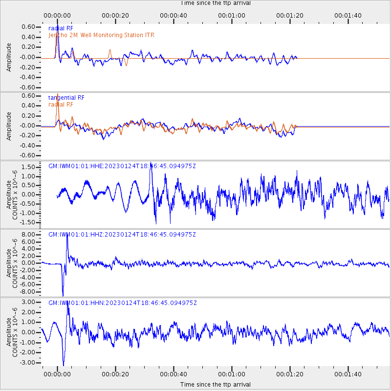
IWM01 Jericho 2M Well Monitoring Station - Earthquake Result Viewer
*The percent match for this event was below the threshold and hence no stack was calculated.
| Earthquake location: |
Santiago Del Estero Prov., Arg. |
| Earthquake latitude/longitude: |
-26.7/-63.1 |
| Earthquake time(UTC): |
2023/01/24 (024) 18:37:00 GMT |
| Earthquake Depth: |
596 km |
| Earthquake Magnitude: |
6.4 mww |
| Earthquake Catalog/Contributor: |
NEIC PDE/us |
|
| Network: |
GM US Geological Survey Networks |
| Station: |
IWM01 Jericho 2M Well Monitoring Station |
| Lat/Lon: |
36.73 N/96.53 W |
| Elevation: |
328 m |
|
| Distance: |
70.5 deg |
| Az: |
332.014 deg |
| Baz: |
148.51 deg |
| Ray Param: |
$rayparam |
*The percent match for this event was below the threshold and hence was not used in the summary stack. |
|
| Radial Match: |
68.24921 % |
| Radial Bump: |
400 |
| Transverse Match: |
39.821136 % |
| Transverse Bump: |
400 |
| SOD ConfigId: |
29823551 |
| Insert Time: |
2023-02-07 18:47:45.951 +0000 |
| GWidth: |
2.5 |
| Max Bumps: |
400 |
| Tol: |
0.001 |
|
Signal To Noise
| Channel | StoN | STA | LTA |
| GM:IWM01:01:HHZ:20230124T18:46:45.094975Z | 13.368752 | 3.330772E-6 | 2.4914607E-7 |
| GM:IWM01:01:HHN:20230124T18:46:45.094975Z | 4.908654 | 1.493458E-6 | 3.0424997E-7 |
| GM:IWM01:01:HHE:20230124T18:46:45.094975Z | 2.0914595 | 7.4714376E-7 | 3.572356E-7 |
| Arrivals |
| Ps | |
| PpPs | |
| PsPs/PpSs | |


