You are here: Home > Network List > TA - USArray Transportable Network (new EarthScope stations) Stations List
> Station W27A Bowe Ranch, Endee, NM, USA > Earthquake Result Viewer
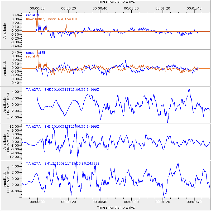
W27A Bowe Ranch, Endee, NM, USA - Earthquake Result Viewer
*The percent match for this event was below the threshold and hence no stack was calculated.
| Earthquake location: |
Near Coast Of Central Chile |
| Earthquake latitude/longitude: |
-34.3/-71.8 |
| Earthquake time(UTC): |
2010/03/11 (070) 14:55:27 GMT |
| Earthquake Depth: |
18 km |
| Earthquake Magnitude: |
6.5 MB, 6.7 MW |
| Earthquake Catalog/Contributor: |
WHDF/NEIC |
|
| Network: |
TA USArray Transportable Network (new EarthScope stations) |
| Station: |
W27A Bowe Ranch, Endee, NM, USA |
| Lat/Lon: |
35.06 N/103.06 W |
| Elevation: |
1233 m |
|
| Distance: |
75.0 deg |
| Az: |
333.843 deg |
| Baz: |
153.592 deg |
| Ray Param: |
$rayparam |
*The percent match for this event was below the threshold and hence was not used in the summary stack. |
|
| Radial Match: |
67.7952 % |
| Radial Bump: |
400 |
| Transverse Match: |
75.78189 % |
| Transverse Bump: |
374 |
| SOD ConfigId: |
299721 |
| Insert Time: |
2010-04-26 22:55:11.649 +0000 |
| GWidth: |
2.5 |
| Max Bumps: |
400 |
| Tol: |
0.001 |
|
Signal To Noise
| Channel | StoN | STA | LTA |
| TA:W27A: :BHZ:20100311T15:06:36.24999Z | 2.597262 | 2.880936E-6 | 1.1092205E-6 |
| TA:W27A: :BHN:20100311T15:06:36.24999Z | 1.5674404 | 2.3963007E-6 | 1.5287987E-6 |
| TA:W27A: :BHE:20100311T15:06:36.24999Z | 2.3184216 | 2.9620148E-6 | 1.2775997E-6 |
| Arrivals |
| Ps | |
| PpPs | |
| PsPs/PpSs | |


