You are here: Home > Network List > TA - USArray Transportable Network (new EarthScope stations) Stations List
> Station I20A Worland, WY, USA > Earthquake Result Viewer
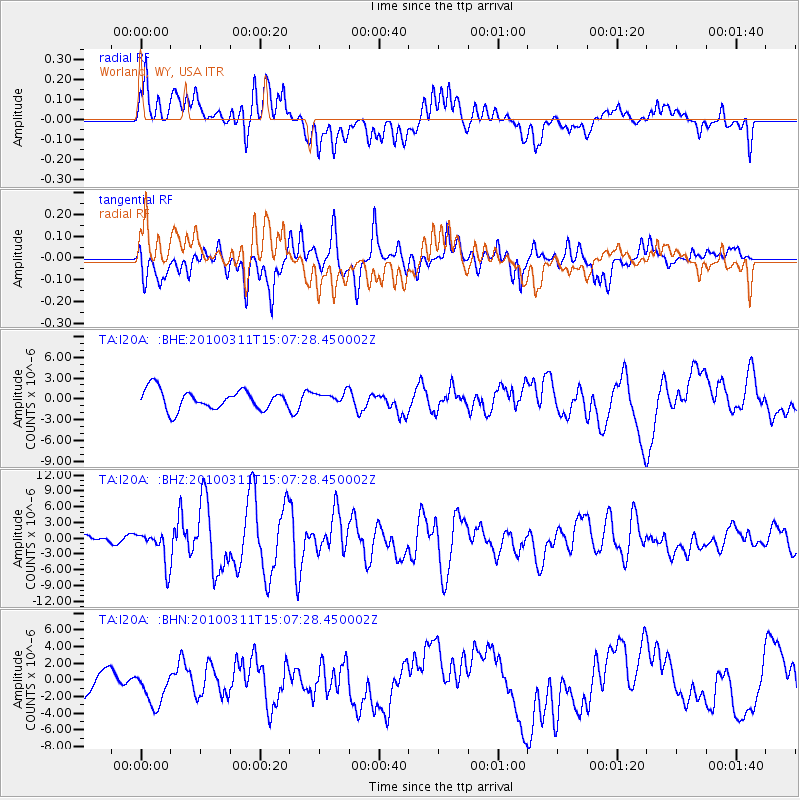
I20A Worland, WY, USA - Earthquake Result Viewer
*The percent match for this event was below the threshold and hence no stack was calculated.
| Earthquake location: |
Near Coast Of Central Chile |
| Earthquake latitude/longitude: |
-34.3/-71.8 |
| Earthquake time(UTC): |
2010/03/11 (070) 14:55:27 GMT |
| Earthquake Depth: |
18 km |
| Earthquake Magnitude: |
6.5 MB, 6.7 MW |
| Earthquake Catalog/Contributor: |
WHDF/NEIC |
|
| Network: |
TA USArray Transportable Network (new EarthScope stations) |
| Station: |
I20A Worland, WY, USA |
| Lat/Lon: |
43.95 N/108.13 W |
| Elevation: |
1342 m |
|
| Distance: |
84.6 deg |
| Az: |
334.546 deg |
| Baz: |
150.496 deg |
| Ray Param: |
$rayparam |
*The percent match for this event was below the threshold and hence was not used in the summary stack. |
|
| Radial Match: |
49.24161 % |
| Radial Bump: |
400 |
| Transverse Match: |
58.196228 % |
| Transverse Bump: |
400 |
| SOD ConfigId: |
299721 |
| Insert Time: |
2010-04-26 22:57:38.086 +0000 |
| GWidth: |
2.5 |
| Max Bumps: |
400 |
| Tol: |
0.001 |
|
Signal To Noise
| Channel | StoN | STA | LTA |
| TA:I20A: :BHZ:20100311T15:07:28.450002Z | 3.2143135 | 3.1637733E-6 | 9.842765E-7 |
| TA:I20A: :BHN:20100311T15:07:28.450002Z | 0.87754387 | 2.3259809E-6 | 2.650558E-6 |
| TA:I20A: :BHE:20100311T15:07:28.450002Z | 0.5927325 | 8.340499E-7 | 1.4071271E-6 |
| Arrivals |
| Ps | |
| PpPs | |
| PsPs/PpSs | |


