You are here: Home > Network List > TA - USArray Transportable Network (new EarthScope stations) Stations List
> Station R23A Moffat, CO, USA > Earthquake Result Viewer
R23A Moffat, CO, USA - Earthquake Result Viewer
*The percent match for this event was below the threshold and hence no stack was calculated.
| Earthquake location: |
Near Coast Of Central Chile |
| Earthquake latitude/longitude: |
-34.3/-71.8 |
| Earthquake time(UTC): |
2010/03/11 (070) 14:55:27 GMT |
| Earthquake Depth: |
18 km |
| Earthquake Magnitude: |
6.5 MB, 6.7 MW |
| Earthquake Catalog/Contributor: |
WHDF/NEIC |
|
| Network: |
TA USArray Transportable Network (new EarthScope stations) |
| Station: |
R23A Moffat, CO, USA |
| Lat/Lon: |
38.19 N/105.83 W |
| Elevation: |
2547 m |
|
| Distance: |
78.8 deg |
| Az: |
333.283 deg |
| Baz: |
151.823 deg |
| Ray Param: |
$rayparam |
*The percent match for this event was below the threshold and hence was not used in the summary stack. |
|
| Radial Match: |
56.927338 % |
| Radial Bump: |
400 |
| Transverse Match: |
67.559044 % |
| Transverse Bump: |
400 |
| SOD ConfigId: |
299721 |
| Insert Time: |
2010-04-26 23:02:39.895 +0000 |
| GWidth: |
2.5 |
| Max Bumps: |
400 |
| Tol: |
0.001 |
|
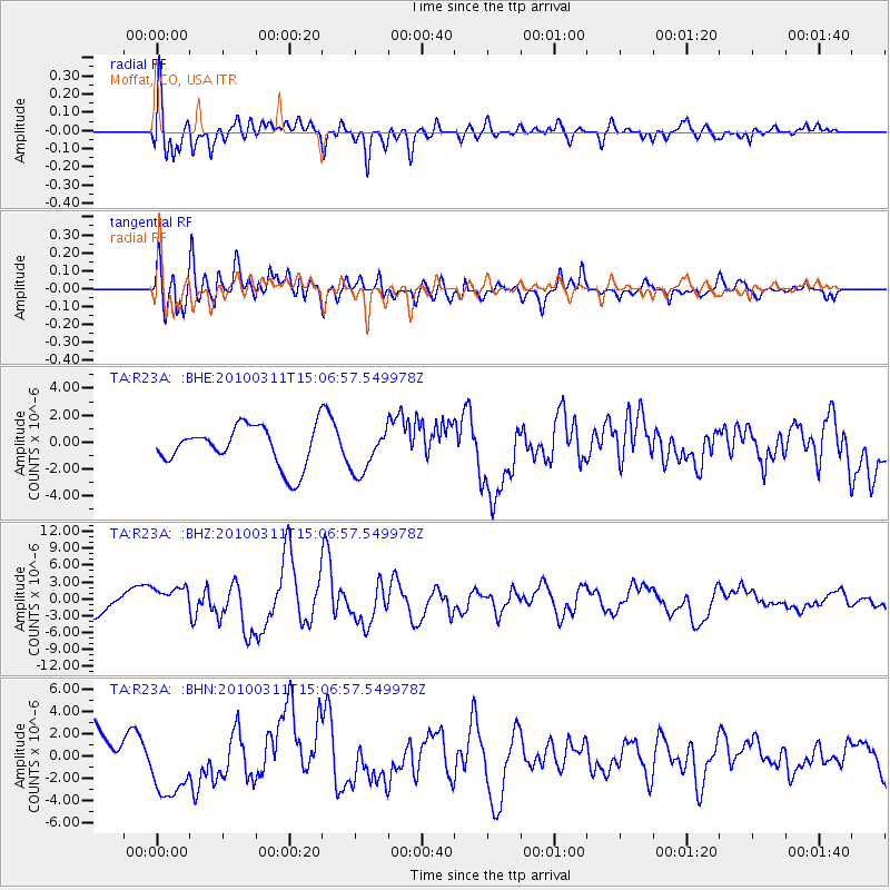
Signal To Noise
| Channel | StoN | STA | LTA |
| TA:R23A: :BHZ:20100311T15:06:57.549978Z | 1.2498755 | 2.3206046E-6 | 1.8566685E-6 |
| TA:R23A: :BHN:20100311T15:06:57.549978Z | 2.0630865 | 3.1144295E-6 | 1.5095973E-6 |
| TA:R23A: :BHE:20100311T15:06:57.549978Z | 1.0759519 | 1.5878688E-6 | 1.4757804E-6 |
| Arrivals |
| Ps | |
| PpPs | |
| PsPs/PpSs | |


