You are here: Home > Network List > TA - USArray Transportable Network (new EarthScope stations) Stations List
> Station V29A Stinnett, TX, USA > Earthquake Result Viewer
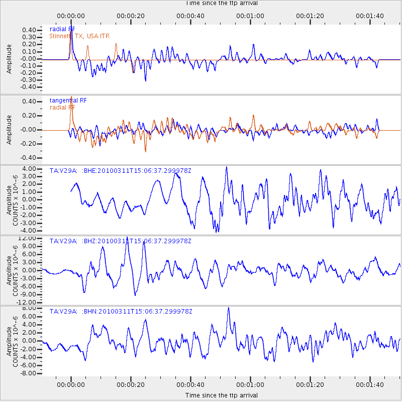
V29A Stinnett, TX, USA - Earthquake Result Viewer
*The percent match for this event was below the threshold and hence no stack was calculated.
| Earthquake location: |
Near Coast Of Central Chile |
| Earthquake latitude/longitude: |
-34.3/-71.8 |
| Earthquake time(UTC): |
2010/03/11 (070) 14:55:27 GMT |
| Earthquake Depth: |
18 km |
| Earthquake Magnitude: |
6.5 MB, 6.7 MW |
| Earthquake Catalog/Contributor: |
WHDF/NEIC |
|
| Network: |
TA USArray Transportable Network (new EarthScope stations) |
| Station: |
V29A Stinnett, TX, USA |
| Lat/Lon: |
35.87 N/101.52 W |
| Elevation: |
953 m |
|
| Distance: |
75.2 deg |
| Az: |
335.379 deg |
| Baz: |
154.879 deg |
| Ray Param: |
$rayparam |
*The percent match for this event was below the threshold and hence was not used in the summary stack. |
|
| Radial Match: |
74.03344 % |
| Radial Bump: |
400 |
| Transverse Match: |
51.180286 % |
| Transverse Bump: |
400 |
| SOD ConfigId: |
299721 |
| Insert Time: |
2010-04-26 23:05:17.127 +0000 |
| GWidth: |
2.5 |
| Max Bumps: |
400 |
| Tol: |
0.001 |
|
Signal To Noise
| Channel | StoN | STA | LTA |
| TA:V29A: :BHZ:20100311T15:06:37.299978Z | 2.2922719 | 3.2264861E-6 | 1.4075496E-6 |
| TA:V29A: :BHN:20100311T15:06:37.299978Z | 1.3831699 | 2.3063656E-6 | 1.6674492E-6 |
| TA:V29A: :BHE:20100311T15:06:37.299978Z | 1.9111714 | 1.9942113E-6 | 1.0434497E-6 |
| Arrivals |
| Ps | |
| PpPs | |
| PsPs/PpSs | |


