You are here: Home > Network List > TA - USArray Transportable Network (new EarthScope stations) Stations List
> Station S31A Mullinville, KS, USA > Earthquake Result Viewer
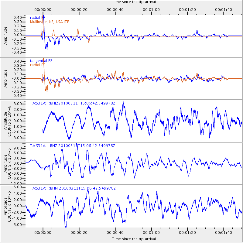
S31A Mullinville, KS, USA - Earthquake Result Viewer
*The percent match for this event was below the threshold and hence no stack was calculated.
| Earthquake location: |
Near Coast Of Central Chile |
| Earthquake latitude/longitude: |
-34.3/-71.8 |
| Earthquake time(UTC): |
2010/03/11 (070) 14:55:27 GMT |
| Earthquake Depth: |
18 km |
| Earthquake Magnitude: |
6.5 MB, 6.7 MW |
| Earthquake Catalog/Contributor: |
WHDF/NEIC |
|
| Network: |
TA USArray Transportable Network (new EarthScope stations) |
| Station: |
S31A Mullinville, KS, USA |
| Lat/Lon: |
37.62 N/99.48 W |
| Elevation: |
700 m |
|
| Distance: |
76.1 deg |
| Az: |
337.658 deg |
| Baz: |
156.659 deg |
| Ray Param: |
$rayparam |
*The percent match for this event was below the threshold and hence was not used in the summary stack. |
|
| Radial Match: |
58.610744 % |
| Radial Bump: |
397 |
| Transverse Match: |
49.23102 % |
| Transverse Bump: |
400 |
| SOD ConfigId: |
299721 |
| Insert Time: |
2010-04-26 23:08:10.211 +0000 |
| GWidth: |
2.5 |
| Max Bumps: |
400 |
| Tol: |
0.001 |
|
Signal To Noise
| Channel | StoN | STA | LTA |
| TA:S31A: :BHZ:20100311T15:06:42.549978Z | 2.7751358 | 3.4177244E-6 | 1.2315522E-6 |
| TA:S31A: :BHN:20100311T15:06:42.549978Z | 1.0239323 | 1.529166E-6 | 1.4934247E-6 |
| TA:S31A: :BHE:20100311T15:06:42.549978Z | 0.9574681 | 1.2510416E-6 | 1.3066143E-6 |
| Arrivals |
| Ps | |
| PpPs | |
| PsPs/PpSs | |


