You are here: Home > Network List > TA - USArray Transportable Network (new EarthScope stations) Stations List
> Station R30A Dighton, KS, USA > Earthquake Result Viewer
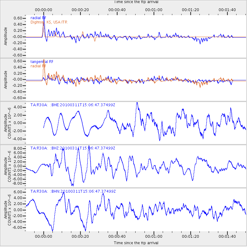
R30A Dighton, KS, USA - Earthquake Result Viewer
*The percent match for this event was below the threshold and hence no stack was calculated.
| Earthquake location: |
Near Coast Of Central Chile |
| Earthquake latitude/longitude: |
-34.3/-71.8 |
| Earthquake time(UTC): |
2010/03/11 (070) 14:55:27 GMT |
| Earthquake Depth: |
18 km |
| Earthquake Magnitude: |
6.5 MB, 6.7 MW |
| Earthquake Catalog/Contributor: |
WHDF/NEIC |
|
| Network: |
TA USArray Transportable Network (new EarthScope stations) |
| Station: |
R30A Dighton, KS, USA |
| Lat/Lon: |
38.28 N/100.28 W |
| Elevation: |
776 m |
|
| Distance: |
76.9 deg |
| Az: |
337.341 deg |
| Baz: |
156.1 deg |
| Ray Param: |
$rayparam |
*The percent match for this event was below the threshold and hence was not used in the summary stack. |
|
| Radial Match: |
60.17333 % |
| Radial Bump: |
400 |
| Transverse Match: |
67.99873 % |
| Transverse Bump: |
400 |
| SOD ConfigId: |
299721 |
| Insert Time: |
2010-04-26 23:08:40.728 +0000 |
| GWidth: |
2.5 |
| Max Bumps: |
400 |
| Tol: |
0.001 |
|
Signal To Noise
| Channel | StoN | STA | LTA |
| TA:R30A: :BHZ:20100311T15:06:47.37499Z | 1.0450629 | 1.6653864E-6 | 1.5935752E-6 |
| TA:R30A: :BHN:20100311T15:06:47.37499Z | 1.8074199 | 3.9710185E-6 | 2.1970648E-6 |
| TA:R30A: :BHE:20100311T15:06:47.37499Z | 0.6925387 | 1.2861885E-6 | 1.8572083E-6 |
| Arrivals |
| Ps | |
| PpPs | |
| PsPs/PpSs | |


