You are here: Home > Network List > TA - USArray Transportable Network (new EarthScope stations) Stations List
> Station H28A Mission Ridge, SD, USA > Earthquake Result Viewer
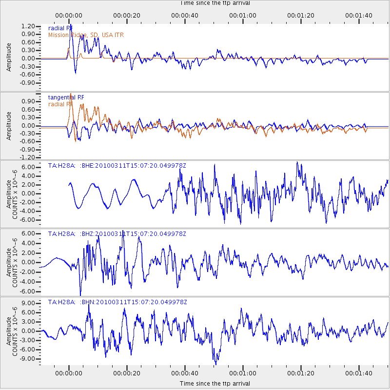
H28A Mission Ridge, SD, USA - Earthquake Result Viewer
*The percent match for this event was below the threshold and hence no stack was calculated.
| Earthquake location: |
Near Coast Of Central Chile |
| Earthquake latitude/longitude: |
-34.3/-71.8 |
| Earthquake time(UTC): |
2010/03/11 (070) 14:55:27 GMT |
| Earthquake Depth: |
18 km |
| Earthquake Magnitude: |
6.5 MB, 6.7 MW |
| Earthquake Catalog/Contributor: |
WHDF/NEIC |
|
| Network: |
TA USArray Transportable Network (new EarthScope stations) |
| Station: |
H28A Mission Ridge, SD, USA |
| Lat/Lon: |
44.68 N/101.02 W |
| Elevation: |
642 m |
|
| Distance: |
83.0 deg |
| Az: |
339.455 deg |
| Baz: |
155.977 deg |
| Ray Param: |
$rayparam |
*The percent match for this event was below the threshold and hence was not used in the summary stack. |
|
| Radial Match: |
72.90134 % |
| Radial Bump: |
400 |
| Transverse Match: |
70.03414 % |
| Transverse Bump: |
400 |
| SOD ConfigId: |
299721 |
| Insert Time: |
2010-04-26 23:11:49.363 +0000 |
| GWidth: |
2.5 |
| Max Bumps: |
400 |
| Tol: |
0.001 |
|
Signal To Noise
| Channel | StoN | STA | LTA |
| TA:H28A: :BHZ:20100311T15:07:20.049978Z | 6.239773 | 2.0903865E-6 | 3.3501001E-7 |
| TA:H28A: :BHN:20100311T15:07:20.049978Z | 1.1866169 | 1.4835208E-6 | 1.2502105E-6 |
| TA:H28A: :BHE:20100311T15:07:20.049978Z | 0.9395318 | 1.8184294E-6 | 1.9354634E-6 |
| Arrivals |
| Ps | |
| PpPs | |
| PsPs/PpSs | |


