You are here: Home > Network List > US - United States National Seismic Network Stations List
> Station MIAR Mount Ida, Arkansas, USA > Earthquake Result Viewer
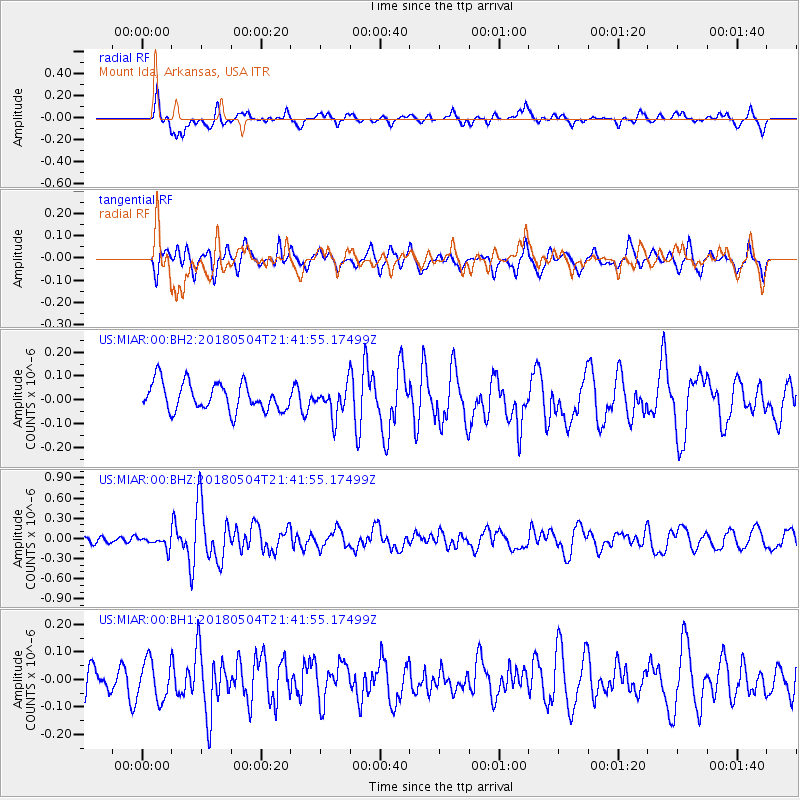
MIAR Mount Ida, Arkansas, USA - Earthquake Result Viewer
*The percent match for this event was below the threshold and hence no stack was calculated.
| Earthquake location: |
Hawaii |
| Earthquake latitude/longitude: |
19.3/-155.0 |
| Earthquake time(UTC): |
2018/05/04 (124) 21:32:44 GMT |
| Earthquake Depth: |
6.9 km |
| Earthquake Magnitude: |
5.7 Ml |
| Earthquake Catalog/Contributor: |
NEIC PDE/hv |
|
| Network: |
US United States National Seismic Network |
| Station: |
MIAR Mount Ida, Arkansas, USA |
| Lat/Lon: |
34.55 N/93.58 W |
| Elevation: |
207 m |
|
| Distance: |
56.1 deg |
| Az: |
60.927 deg |
| Baz: |
271.179 deg |
| Ray Param: |
$rayparam |
*The percent match for this event was below the threshold and hence was not used in the summary stack. |
|
| Radial Match: |
70.86167 % |
| Radial Bump: |
400 |
| Transverse Match: |
50.433758 % |
| Transverse Bump: |
400 |
| SOD ConfigId: |
2973751 |
| Insert Time: |
2018-10-09 11:50:21.186 +0000 |
| GWidth: |
2.5 |
| Max Bumps: |
400 |
| Tol: |
0.001 |
|
Signal To Noise
| Channel | StoN | STA | LTA |
| US:MIAR:00:BHZ:20180504T21:41:55.17499Z | 1.371594 | 8.8925304E-8 | 6.483355E-8 |
| US:MIAR:00:BH1:20180504T21:41:55.17499Z | 1.2827641 | 7.068105E-8 | 5.5100585E-8 |
| US:MIAR:00:BH2:20180504T21:41:55.17499Z | 1.1425012 | 6.726569E-8 | 5.8875813E-8 |
| Arrivals |
| Ps | |
| PpPs | |
| PsPs/PpSs | |


