You are here: Home > Network List > TA - USArray Transportable Network (new EarthScope stations) Stations List
> Station X34A Smith Ranch, Marlow, OK, USA > Earthquake Result Viewer
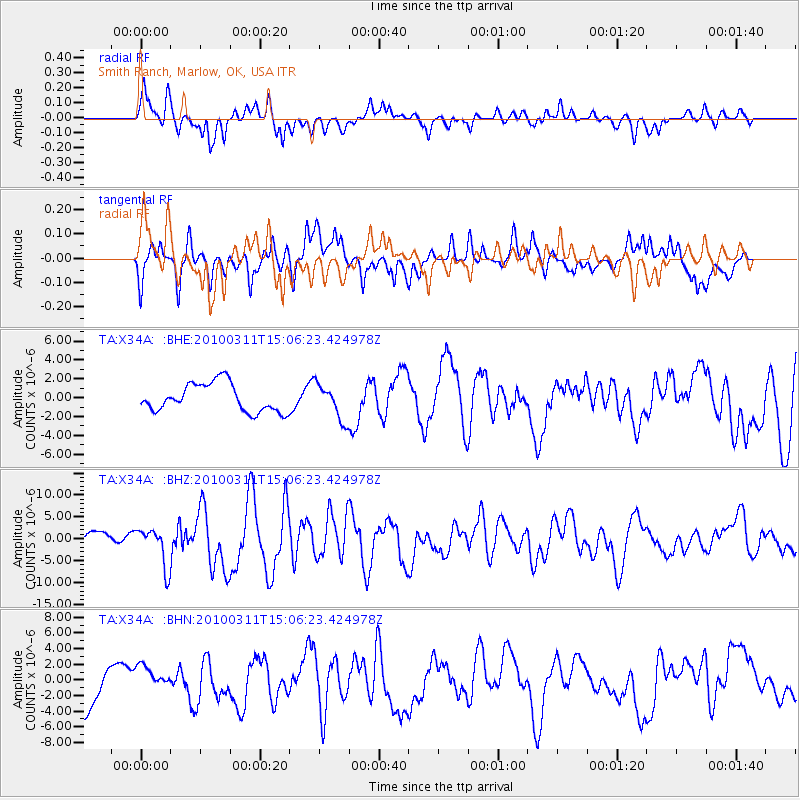
X34A Smith Ranch, Marlow, OK, USA - Earthquake Result Viewer
*The percent match for this event was below the threshold and hence no stack was calculated.
| Earthquake location: |
Near Coast Of Central Chile |
| Earthquake latitude/longitude: |
-34.3/-71.8 |
| Earthquake time(UTC): |
2010/03/11 (070) 14:55:27 GMT |
| Earthquake Depth: |
18 km |
| Earthquake Magnitude: |
6.5 MB, 6.7 MW |
| Earthquake Catalog/Contributor: |
WHDF/NEIC |
|
| Network: |
TA USArray Transportable Network (new EarthScope stations) |
| Station: |
X34A Smith Ranch, Marlow, OK, USA |
| Lat/Lon: |
34.60 N/97.83 W |
| Elevation: |
364 m |
|
| Distance: |
72.8 deg |
| Az: |
337.723 deg |
| Baz: |
157.646 deg |
| Ray Param: |
$rayparam |
*The percent match for this event was below the threshold and hence was not used in the summary stack. |
|
| Radial Match: |
72.56696 % |
| Radial Bump: |
400 |
| Transverse Match: |
71.52779 % |
| Transverse Bump: |
355 |
| SOD ConfigId: |
299721 |
| Insert Time: |
2010-04-26 23:18:39.687 +0000 |
| GWidth: |
2.5 |
| Max Bumps: |
400 |
| Tol: |
0.001 |
|
Signal To Noise
| Channel | StoN | STA | LTA |
| TA:X34A: :BHZ:20100311T15:06:23.424978Z | 2.65525 | 4.434709E-6 | 1.6701661E-6 |
| TA:X34A: :BHN:20100311T15:06:23.424978Z | 0.89916736 | 1.7605331E-6 | 1.9579593E-6 |
| TA:X34A: :BHE:20100311T15:06:23.424978Z | 1.2741107 | 1.8998709E-6 | 1.491135E-6 |
| Arrivals |
| Ps | |
| PpPs | |
| PsPs/PpSs | |


