You are here: Home > Network List > TA - USArray Transportable Network (new EarthScope stations) Stations List
> Station H20A Greybull, WY, USA > Earthquake Result Viewer
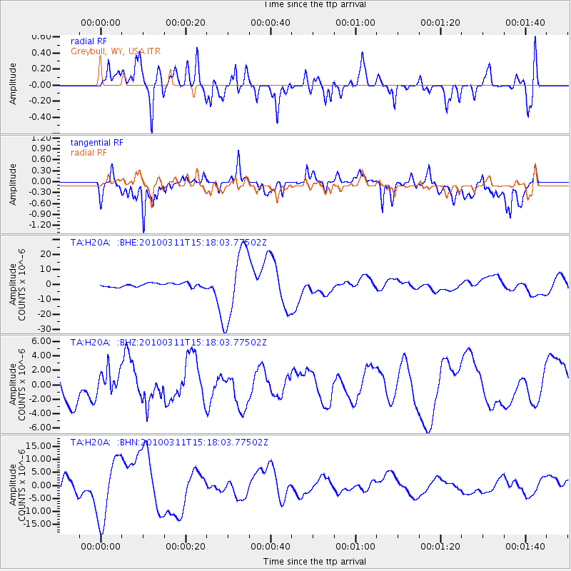
H20A Greybull, WY, USA - Earthquake Result Viewer
*The percent match for this event was below the threshold and hence no stack was calculated.
| Earthquake location: |
Near Coast Of Central Chile |
| Earthquake latitude/longitude: |
-34.5/-72.0 |
| Earthquake time(UTC): |
2010/03/11 (070) 15:06:02 GMT |
| Earthquake Depth: |
32 km |
| Earthquake Magnitude: |
6.0 MB, 5.9 ML |
| Earthquake Catalog/Contributor: |
WHDF/NEIC |
|
| Network: |
TA USArray Transportable Network (new EarthScope stations) |
| Station: |
H20A Greybull, WY, USA |
| Lat/Lon: |
44.49 N/108.00 W |
| Elevation: |
1236 m |
|
| Distance: |
85.1 deg |
| Az: |
335.027 deg |
| Baz: |
150.835 deg |
| Ray Param: |
$rayparam |
*The percent match for this event was below the threshold and hence was not used in the summary stack. |
|
| Radial Match: |
54.51248 % |
| Radial Bump: |
400 |
| Transverse Match: |
37.61959 % |
| Transverse Bump: |
400 |
| SOD ConfigId: |
299721 |
| Insert Time: |
2010-04-26 23:39:03.189 +0000 |
| GWidth: |
2.5 |
| Max Bumps: |
400 |
| Tol: |
0.001 |
|
Signal To Noise
| Channel | StoN | STA | LTA |
| TA:H20A: :BHZ:20100311T15:18:03.77502Z | 1.2663734 | 1.7636078E-6 | 1.3926444E-6 |
| TA:H20A: :BHN:20100311T15:18:03.77502Z | 7.9891825 | 1.2121776E-5 | 1.5172736E-6 |
| TA:H20A: :BHE:20100311T15:18:03.77502Z | 18.89366 | 2.3610599E-5 | 1.2496572E-6 |
| Arrivals |
| Ps | |
| PpPs | |
| PsPs/PpSs | |


