You are here: Home > Network List > TA - USArray Transportable Network (new EarthScope stations) Stations List
> Station D24A Glendive, MT, USA > Earthquake Result Viewer
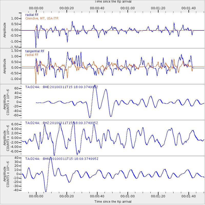
D24A Glendive, MT, USA - Earthquake Result Viewer
*The percent match for this event was below the threshold and hence no stack was calculated.
| Earthquake location: |
Near Coast Of Central Chile |
| Earthquake latitude/longitude: |
-34.5/-72.0 |
| Earthquake time(UTC): |
2010/03/11 (070) 15:06:02 GMT |
| Earthquake Depth: |
32 km |
| Earthquake Magnitude: |
6.0 MB, 5.9 ML |
| Earthquake Catalog/Contributor: |
WHDF/NEIC |
|
| Network: |
TA USArray Transportable Network (new EarthScope stations) |
| Station: |
D24A Glendive, MT, USA |
| Lat/Lon: |
47.12 N/104.33 W |
| Elevation: |
766 m |
|
| Distance: |
86.3 deg |
| Az: |
338.533 deg |
| Baz: |
153.724 deg |
| Ray Param: |
$rayparam |
*The percent match for this event was below the threshold and hence was not used in the summary stack. |
|
| Radial Match: |
36.775467 % |
| Radial Bump: |
308 |
| Transverse Match: |
30.70528 % |
| Transverse Bump: |
316 |
| SOD ConfigId: |
299721 |
| Insert Time: |
2010-04-26 23:40:49.826 +0000 |
| GWidth: |
2.5 |
| Max Bumps: |
400 |
| Tol: |
0.001 |
|
Signal To Noise
| Channel | StoN | STA | LTA |
| TA:D24A: :BHZ:20100311T15:18:09.374995Z | 1.4392434 | 2.2773722E-6 | 1.5823398E-6 |
| TA:D24A: :BHN:20100311T15:18:09.374995Z | 1.194726 | 3.9768356E-6 | 3.328659E-6 |
| TA:D24A: :BHE:20100311T15:18:09.374995Z | 6.470435 | 2.1504167E-5 | 3.3234498E-6 |
| Arrivals |
| Ps | |
| PpPs | |
| PsPs/PpSs | |


