You are here: Home > Network List > TA - USArray Transportable Network (new EarthScope stations) Stations List
> Station Q28A Sharon Springs, KS, USA > Earthquake Result Viewer
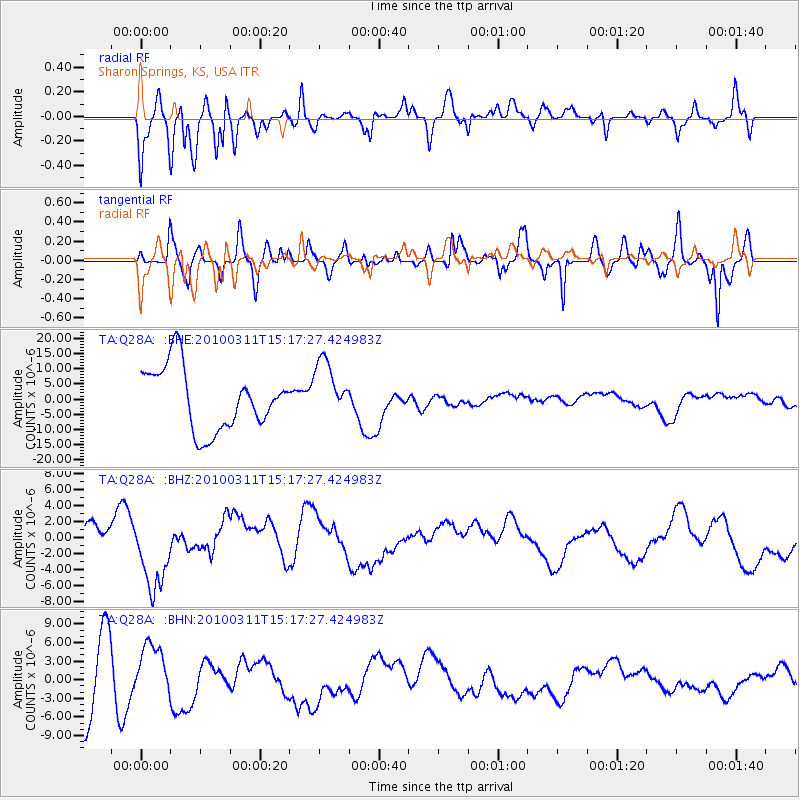
Q28A Sharon Springs, KS, USA - Earthquake Result Viewer
*The percent match for this event was below the threshold and hence no stack was calculated.
| Earthquake location: |
Near Coast Of Central Chile |
| Earthquake latitude/longitude: |
-34.5/-72.0 |
| Earthquake time(UTC): |
2010/03/11 (070) 15:06:02 GMT |
| Earthquake Depth: |
32 km |
| Earthquake Magnitude: |
6.0 MB, 5.9 ML |
| Earthquake Catalog/Contributor: |
WHDF/NEIC |
|
| Network: |
TA USArray Transportable Network (new EarthScope stations) |
| Station: |
Q28A Sharon Springs, KS, USA |
| Lat/Lon: |
39.06 N/101.83 W |
| Elevation: |
1133 m |
|
| Distance: |
78.2 deg |
| Az: |
336.698 deg |
| Baz: |
155.178 deg |
| Ray Param: |
$rayparam |
*The percent match for this event was below the threshold and hence was not used in the summary stack. |
|
| Radial Match: |
53.879597 % |
| Radial Bump: |
400 |
| Transverse Match: |
32.07508 % |
| Transverse Bump: |
305 |
| SOD ConfigId: |
299721 |
| Insert Time: |
2010-04-26 23:44:26.698 +0000 |
| GWidth: |
2.5 |
| Max Bumps: |
400 |
| Tol: |
0.001 |
|
Signal To Noise
| Channel | StoN | STA | LTA |
| TA:Q28A: :BHZ:20100311T15:17:27.424983Z | 2.0760338 | 5.0963554E-6 | 2.454852E-6 |
| TA:Q28A: :BHN:20100311T15:17:27.424983Z | 0.76636124 | 4.100207E-6 | 5.3502276E-6 |
| TA:Q28A: :BHE:20100311T15:17:27.424983Z | 0.92797244 | 9.527111E-6 | 1.0266588E-5 |
| Arrivals |
| Ps | |
| PpPs | |
| PsPs/PpSs | |


