You are here: Home > Network List > IW - Intermountain West Stations List
> Station MOOW Moose Ponds, Wyoming, USA > Earthquake Result Viewer
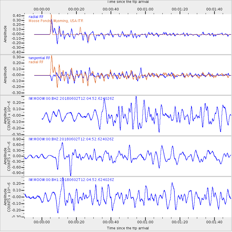
MOOW Moose Ponds, Wyoming, USA - Earthquake Result Viewer
*The percent match for this event was below the threshold and hence no stack was calculated.
| Earthquake location: |
Samoa Islands Region |
| Earthquake latitude/longitude: |
-14.8/-173.1 |
| Earthquake time(UTC): |
2018/06/02 (153) 11:53:06 GMT |
| Earthquake Depth: |
50 km |
| Earthquake Magnitude: |
5.6 mb |
| Earthquake Catalog/Contributor: |
NEIC PDE/us |
|
| Network: |
IW Intermountain West |
| Station: |
MOOW Moose Ponds, Wyoming, USA |
| Lat/Lon: |
43.75 N/110.74 W |
| Elevation: |
2128 m |
|
| Distance: |
81.3 deg |
| Az: |
40.497 deg |
| Baz: |
240.093 deg |
| Ray Param: |
$rayparam |
*The percent match for this event was below the threshold and hence was not used in the summary stack. |
|
| Radial Match: |
78.983284 % |
| Radial Bump: |
400 |
| Transverse Match: |
67.79931 % |
| Transverse Bump: |
400 |
| SOD ConfigId: |
2973751 |
| Insert Time: |
2018-10-09 13:04:40.614 +0000 |
| GWidth: |
2.5 |
| Max Bumps: |
400 |
| Tol: |
0.001 |
|
Signal To Noise
| Channel | StoN | STA | LTA |
| IW:MOOW:00:BHZ:20180602T12:04:52.624026Z | 1.6974636 | 7.3562944E-8 | 4.333698E-8 |
| IW:MOOW:00:BH1:20180602T12:04:52.624026Z | 1.2844532 | 4.8244072E-8 | 3.7560007E-8 |
| IW:MOOW:00:BH2:20180602T12:04:52.624026Z | 0.5787911 | 2.9535654E-8 | 5.1029907E-8 |
| Arrivals |
| Ps | |
| PpPs | |
| PsPs/PpSs | |


