You are here: Home > Network List > IW - Intermountain West Stations List
> Station MOOW Moose Ponds, Wyoming, USA > Earthquake Result Viewer
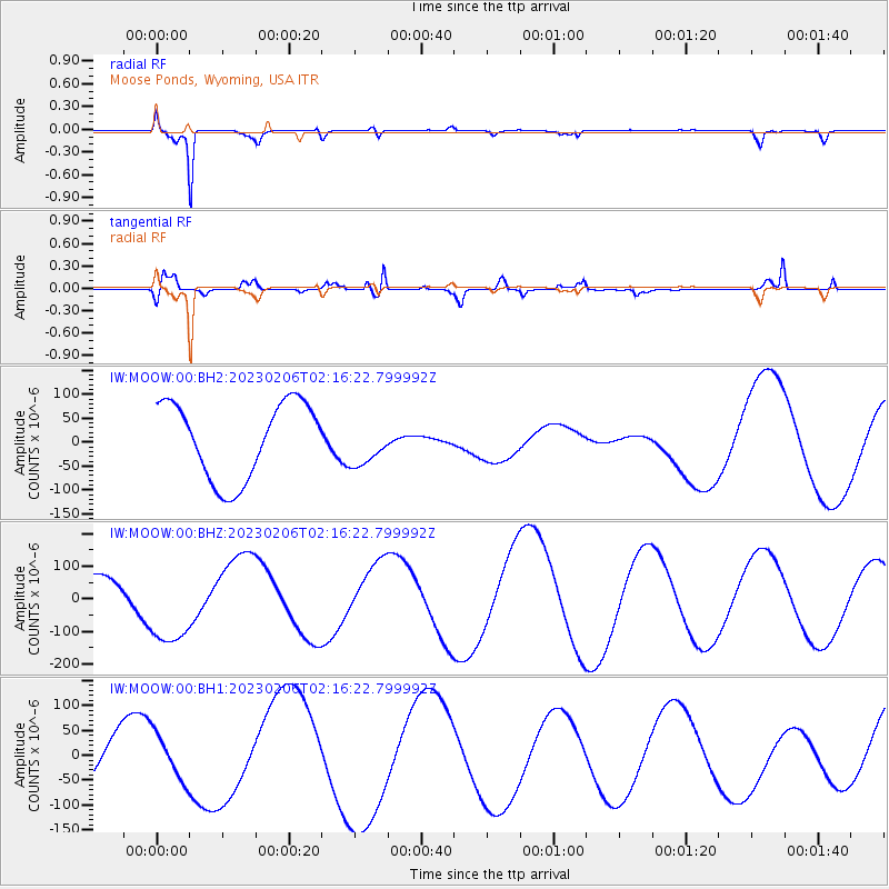
MOOW Moose Ponds, Wyoming, USA - Earthquake Result Viewer
*The percent match for this event was below the threshold and hence no stack was calculated.
| Earthquake location: |
Turkey |
| Earthquake latitude/longitude: |
37.8/37.9 |
| Earthquake time(UTC): |
2023/02/06 (037) 02:03:36 GMT |
| Earthquake Depth: |
10 km |
| Earthquake Magnitude: |
5.5 mb |
| Earthquake Catalog/Contributor: |
NEIC PDE/us |
|
| Network: |
IW Intermountain West |
| Station: |
MOOW Moose Ponds, Wyoming, USA |
| Lat/Lon: |
43.75 N/110.74 W |
| Elevation: |
2128 m |
|
| Distance: |
94.0 deg |
| Az: |
337.802 deg |
| Baz: |
24.399 deg |
| Ray Param: |
$rayparam |
*The percent match for this event was below the threshold and hence was not used in the summary stack. |
|
| Radial Match: |
95.388985 % |
| Radial Bump: |
276 |
| Transverse Match: |
53.549057 % |
| Transverse Bump: |
400 |
| SOD ConfigId: |
29823551 |
| Insert Time: |
2023-02-20 02:42:24.832 +0000 |
| GWidth: |
2.5 |
| Max Bumps: |
400 |
| Tol: |
0.001 |
|
Signal To Noise
| Channel | StoN | STA | LTA |
| IW:MOOW:00:BHZ:20230206T02:16:22.799992Z | 3.635662 | 1.3158876E-4 | 3.619389E-5 |
| IW:MOOW:00:BH1:20230206T02:16:22.799992Z | 0.99715376 | 4.562818E-5 | 4.5758425E-5 |
| IW:MOOW:00:BH2:20230206T02:16:22.799992Z | 0.588104 | 4.6836718E-5 | 7.9640195E-5 |
| Arrivals |
| Ps | |
| PpPs | |
| PsPs/PpSs | |


