You are here: Home > Network List > US - United States National Seismic Network Stations List
> Station HAWA Hanford, Washington, USA > Earthquake Result Viewer
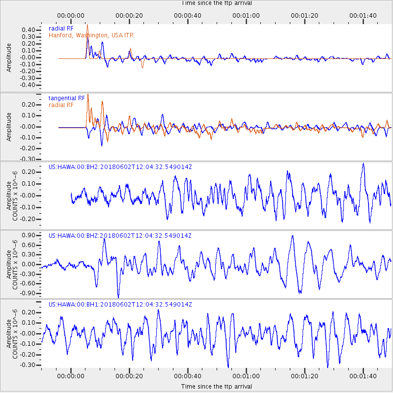
HAWA Hanford, Washington, USA - Earthquake Result Viewer
*The percent match for this event was below the threshold and hence no stack was calculated.
| Earthquake location: |
Samoa Islands Region |
| Earthquake latitude/longitude: |
-14.8/-173.1 |
| Earthquake time(UTC): |
2018/06/02 (153) 11:53:06 GMT |
| Earthquake Depth: |
50 km |
| Earthquake Magnitude: |
5.6 mb |
| Earthquake Catalog/Contributor: |
NEIC PDE/us |
|
| Network: |
US United States National Seismic Network |
| Station: |
HAWA Hanford, Washington, USA |
| Lat/Lon: |
46.39 N/119.53 W |
| Elevation: |
364 m |
|
| Distance: |
77.6 deg |
| Az: |
34.764 deg |
| Baz: |
232.836 deg |
| Ray Param: |
$rayparam |
*The percent match for this event was below the threshold and hence was not used in the summary stack. |
|
| Radial Match: |
77.90804 % |
| Radial Bump: |
400 |
| Transverse Match: |
60.756477 % |
| Transverse Bump: |
400 |
| SOD ConfigId: |
2973751 |
| Insert Time: |
2018-10-09 13:07:02.817 +0000 |
| GWidth: |
2.5 |
| Max Bumps: |
400 |
| Tol: |
0.001 |
|
Signal To Noise
| Channel | StoN | STA | LTA |
| US:HAWA:00:BHZ:20180602T12:04:32.549014Z | 1.1467603 | 6.371429E-8 | 5.556025E-8 |
| US:HAWA:00:BH1:20180602T12:04:32.549014Z | 1.1147128 | 5.852012E-8 | 5.249793E-8 |
| US:HAWA:00:BH2:20180602T12:04:32.549014Z | 0.8358066 | 3.49043E-8 | 4.1761215E-8 |
| Arrivals |
| Ps | |
| PpPs | |
| PsPs/PpSs | |


