You are here: Home > Network List > US - United States National Seismic Network Stations List
> Station WMOK Wichita Mountains, Oklahoma, USA > Earthquake Result Viewer
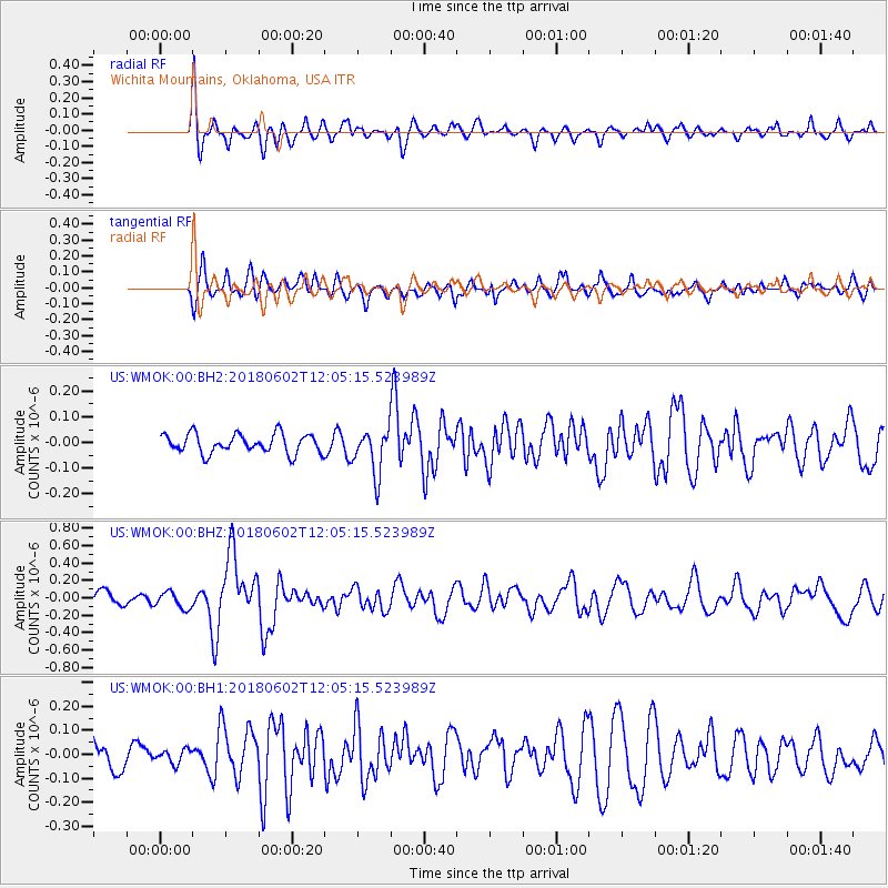
WMOK Wichita Mountains, Oklahoma, USA - Earthquake Result Viewer
*The percent match for this event was below the threshold and hence no stack was calculated.
| Earthquake location: |
Samoa Islands Region |
| Earthquake latitude/longitude: |
-14.8/-173.1 |
| Earthquake time(UTC): |
2018/06/02 (153) 11:53:06 GMT |
| Earthquake Depth: |
50 km |
| Earthquake Magnitude: |
5.6 mb |
| Earthquake Catalog/Contributor: |
NEIC PDE/us |
|
| Network: |
US United States National Seismic Network |
| Station: |
WMOK Wichita Mountains, Oklahoma, USA |
| Lat/Lon: |
34.74 N/98.78 W |
| Elevation: |
486 m |
|
| Distance: |
85.9 deg |
| Az: |
52.652 deg |
| Baz: |
249.027 deg |
| Ray Param: |
$rayparam |
*The percent match for this event was below the threshold and hence was not used in the summary stack. |
|
| Radial Match: |
67.25721 % |
| Radial Bump: |
400 |
| Transverse Match: |
57.706722 % |
| Transverse Bump: |
400 |
| SOD ConfigId: |
2973751 |
| Insert Time: |
2018-10-09 13:07:35.232 +0000 |
| GWidth: |
2.5 |
| Max Bumps: |
400 |
| Tol: |
0.001 |
|
Signal To Noise
| Channel | StoN | STA | LTA |
| US:WMOK:00:BHZ:20180602T12:05:15.523989Z | 1.1253213 | 9.5466284E-8 | 8.4834696E-8 |
| US:WMOK:00:BH1:20180602T12:05:15.523989Z | 0.43653822 | 2.8752522E-8 | 6.5864846E-8 |
| US:WMOK:00:BH2:20180602T12:05:15.523989Z | 1.4413694 | 5.1801212E-8 | 3.593889E-8 |
| Arrivals |
| Ps | |
| PpPs | |
| PsPs/PpSs | |


