You are here: Home > Network List > US - United States National Seismic Network Stations List
> Station WUAZ Wupatki, Arizona, USA > Earthquake Result Viewer
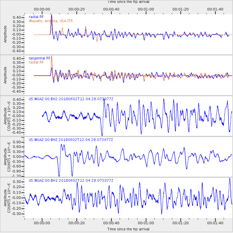
WUAZ Wupatki, Arizona, USA - Earthquake Result Viewer
*The percent match for this event was below the threshold and hence no stack was calculated.
| Earthquake location: |
Samoa Islands Region |
| Earthquake latitude/longitude: |
-14.8/-173.1 |
| Earthquake time(UTC): |
2018/06/02 (153) 11:53:06 GMT |
| Earthquake Depth: |
50 km |
| Earthquake Magnitude: |
5.6 mb |
| Earthquake Catalog/Contributor: |
NEIC PDE/us |
|
| Network: |
US United States National Seismic Network |
| Station: |
WUAZ Wupatki, Arizona, USA |
| Lat/Lon: |
35.52 N/111.37 W |
| Elevation: |
1592 m |
|
| Distance: |
76.9 deg |
| Az: |
47.543 deg |
| Baz: |
241.026 deg |
| Ray Param: |
$rayparam |
*The percent match for this event was below the threshold and hence was not used in the summary stack. |
|
| Radial Match: |
81.717896 % |
| Radial Bump: |
397 |
| Transverse Match: |
78.76877 % |
| Transverse Bump: |
400 |
| SOD ConfigId: |
2973751 |
| Insert Time: |
2018-10-09 13:07:38.687 +0000 |
| GWidth: |
2.5 |
| Max Bumps: |
400 |
| Tol: |
0.001 |
|
Signal To Noise
| Channel | StoN | STA | LTA |
| US:WUAZ:00:BHZ:20180602T12:04:28.073977Z | 0.81577635 | 7.256003E-8 | 8.894598E-8 |
| US:WUAZ:00:BH1:20180602T12:04:28.073977Z | 0.49944836 | 4.054721E-8 | 8.118399E-8 |
| US:WUAZ:00:BH2:20180602T12:04:28.073977Z | 0.81563437 | 5.187291E-8 | 6.359824E-8 |
| Arrivals |
| Ps | |
| PpPs | |
| PsPs/PpSs | |


