You are here: Home > Network List > US - United States National Seismic Network Stations List
> Station AGMN Agassiz National Wildlife Refuge, Minnesota, USA > Earthquake Result Viewer
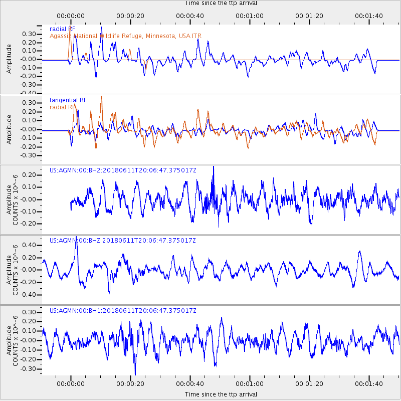
AGMN Agassiz National Wildlife Refuge, Minnesota, USA - Earthquake Result Viewer
*The percent match for this event was below the threshold and hence no stack was calculated.
| Earthquake location: |
Kyushu, Japan |
| Earthquake latitude/longitude: |
31.3/131.5 |
| Earthquake time(UTC): |
2018/06/11 (162) 19:54:21 GMT |
| Earthquake Depth: |
34 km |
| Earthquake Magnitude: |
5.4 Mww |
| Earthquake Catalog/Contributor: |
NEIC PDE/us |
|
| Network: |
US United States National Seismic Network |
| Station: |
AGMN Agassiz National Wildlife Refuge, Minnesota, USA |
| Lat/Lon: |
48.30 N/95.86 W |
| Elevation: |
351 m |
|
| Distance: |
90.2 deg |
| Az: |
29.405 deg |
| Baz: |
320.977 deg |
| Ray Param: |
$rayparam |
*The percent match for this event was below the threshold and hence was not used in the summary stack. |
|
| Radial Match: |
58.51435 % |
| Radial Bump: |
400 |
| Transverse Match: |
61.7144 % |
| Transverse Bump: |
400 |
| SOD ConfigId: |
2973751 |
| Insert Time: |
2018-10-09 13:17:56.331 +0000 |
| GWidth: |
2.5 |
| Max Bumps: |
400 |
| Tol: |
0.001 |
|
Signal To Noise
| Channel | StoN | STA | LTA |
| US:AGMN:00:BHZ:20180611T20:06:47.375017Z | 3.3671443 | 2.3102817E-7 | 6.861249E-8 |
| US:AGMN:00:BH1:20180611T20:06:47.375017Z | 0.62707806 | 4.0502687E-8 | 6.458954E-8 |
| US:AGMN:00:BH2:20180611T20:06:47.375017Z | 0.76063555 | 5.8629524E-8 | 7.7079655E-8 |
| Arrivals |
| Ps | |
| PpPs | |
| PsPs/PpSs | |


