You are here: Home > Network List > IU - Global Seismograph Network (GSN - IRIS/USGS) Stations List
> Station PMG Port Moresby, New Guinea > Earthquake Result Viewer
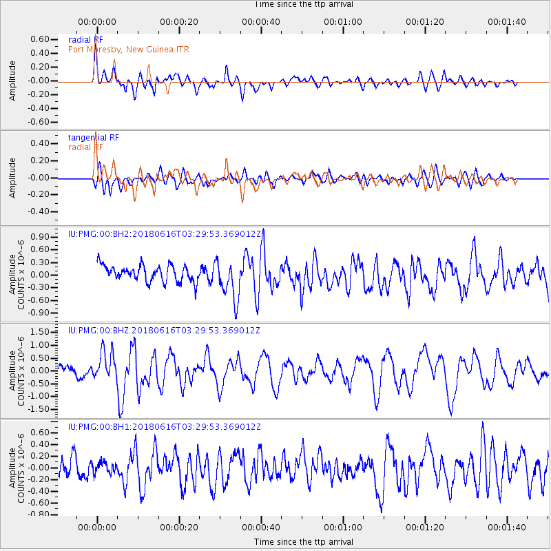
PMG Port Moresby, New Guinea - Earthquake Result Viewer
*The percent match for this event was below the threshold and hence no stack was calculated.
| Earthquake location: |
Fiji Islands Region |
| Earthquake latitude/longitude: |
-16.2/-177.6 |
| Earthquake time(UTC): |
2018/06/16 (167) 03:23:32 GMT |
| Earthquake Depth: |
10 km |
| Earthquake Magnitude: |
5.5 mb |
| Earthquake Catalog/Contributor: |
NEIC PDE/us |
|
| Network: |
IU Global Seismograph Network (GSN - IRIS/USGS) |
| Station: |
PMG Port Moresby, New Guinea |
| Lat/Lon: |
9.40 S/147.16 E |
| Elevation: |
90 m |
|
| Distance: |
35.0 deg |
| Az: |
276.832 deg |
| Baz: |
104.86 deg |
| Ray Param: |
$rayparam |
*The percent match for this event was below the threshold and hence was not used in the summary stack. |
|
| Radial Match: |
74.77745 % |
| Radial Bump: |
400 |
| Transverse Match: |
67.42045 % |
| Transverse Bump: |
400 |
| SOD ConfigId: |
2973751 |
| Insert Time: |
2018-10-09 13:39:03.177 +0000 |
| GWidth: |
2.5 |
| Max Bumps: |
400 |
| Tol: |
0.001 |
|
Signal To Noise
| Channel | StoN | STA | LTA |
| IU:PMG:00:BHZ:20180616T03:29:53.369012Z | 3.280569 | 5.889393E-7 | 1.7952352E-7 |
| IU:PMG:00:BH1:20180616T03:29:53.369012Z | 0.5173878 | 9.220836E-8 | 1.7821904E-7 |
| IU:PMG:00:BH2:20180616T03:29:53.369012Z | 2.5579896 | 4.770134E-7 | 1.8647978E-7 |
| Arrivals |
| Ps | |
| PpPs | |
| PsPs/PpSs | |


