You are here: Home > Network List > US - United States National Seismic Network Stations List
> Station MSO Missoula, Montana, USA > Earthquake Result Viewer
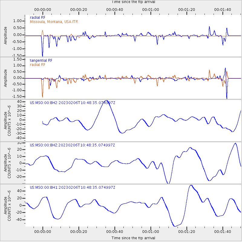
MSO Missoula, Montana, USA - Earthquake Result Viewer
*The percent match for this event was below the threshold and hence no stack was calculated.
| Earthquake location: |
Turkey |
| Earthquake latitude/longitude: |
38.0/37.8 |
| Earthquake time(UTC): |
2023/02/06 (037) 10:35:58 GMT |
| Earthquake Depth: |
10 km |
| Earthquake Magnitude: |
5.8 mb |
| Earthquake Catalog/Contributor: |
NEIC PDE/us |
|
| Network: |
US United States National Seismic Network |
| Station: |
MSO Missoula, Montana, USA |
| Lat/Lon: |
46.83 N/113.94 W |
| Elevation: |
1264 m |
|
| Distance: |
91.8 deg |
| Az: |
340.987 deg |
| Baz: |
22.011 deg |
| Ray Param: |
$rayparam |
*The percent match for this event was below the threshold and hence was not used in the summary stack. |
|
| Radial Match: |
73.18838 % |
| Radial Bump: |
377 |
| Transverse Match: |
40.418633 % |
| Transverse Bump: |
400 |
| SOD ConfigId: |
29823551 |
| Insert Time: |
2023-02-20 11:34:15.849 +0000 |
| GWidth: |
2.5 |
| Max Bumps: |
400 |
| Tol: |
0.001 |
|
Signal To Noise
| Channel | StoN | STA | LTA |
| US:MSO:00:BHZ:20230206T10:48:35.074997Z | 3.0718727 | 1.0823313E-5 | 3.5233597E-6 |
| US:MSO:00:BH1:20230206T10:48:35.074997Z | 1.573076 | 1.8983894E-5 | 1.2068008E-5 |
| US:MSO:00:BH2:20230206T10:48:35.074997Z | 4.358845 | 2.9263232E-5 | 6.713529E-6 |
| Arrivals |
| Ps | |
| PpPs | |
| PsPs/PpSs | |


